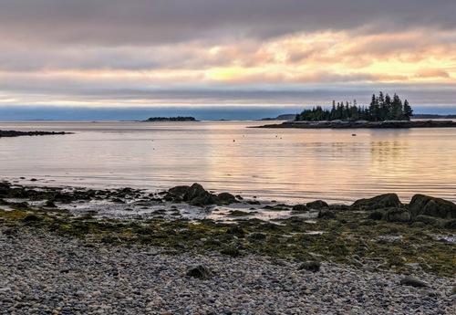
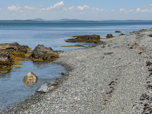
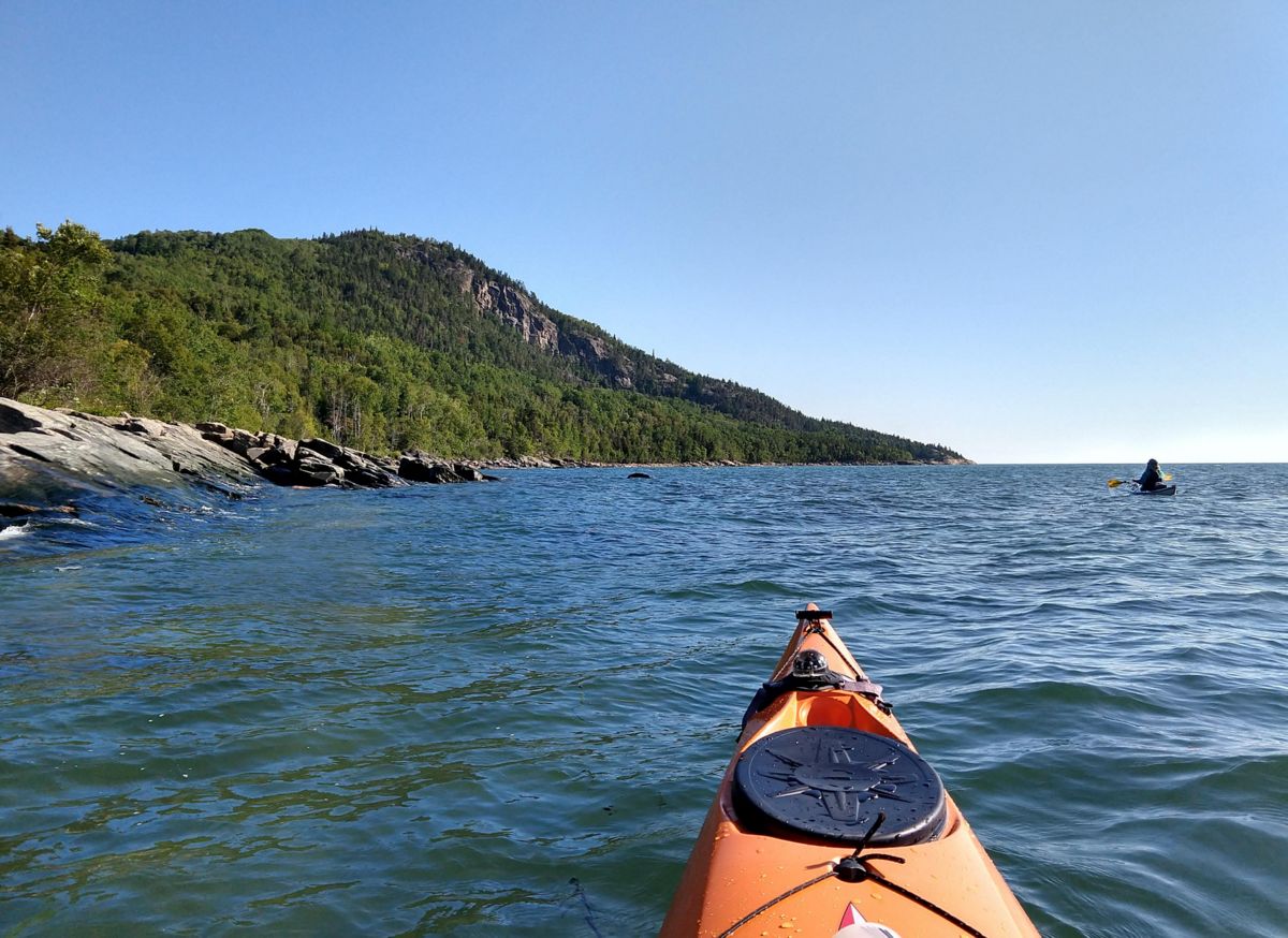
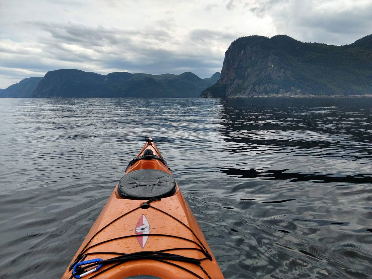
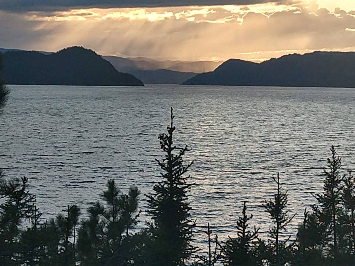
The sparkling, ever-changing waters of Penobscot Bay are a big part of what drew me to the Midcoast. Lots of people can say the same.
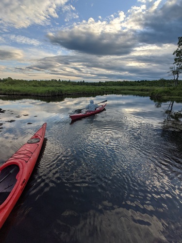
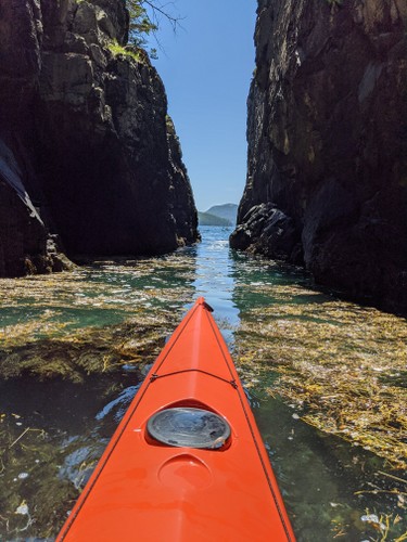
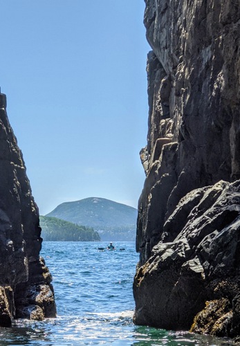
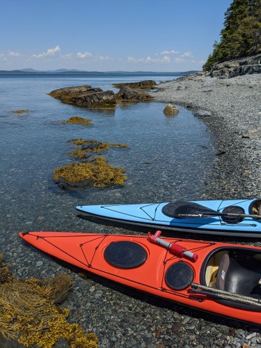
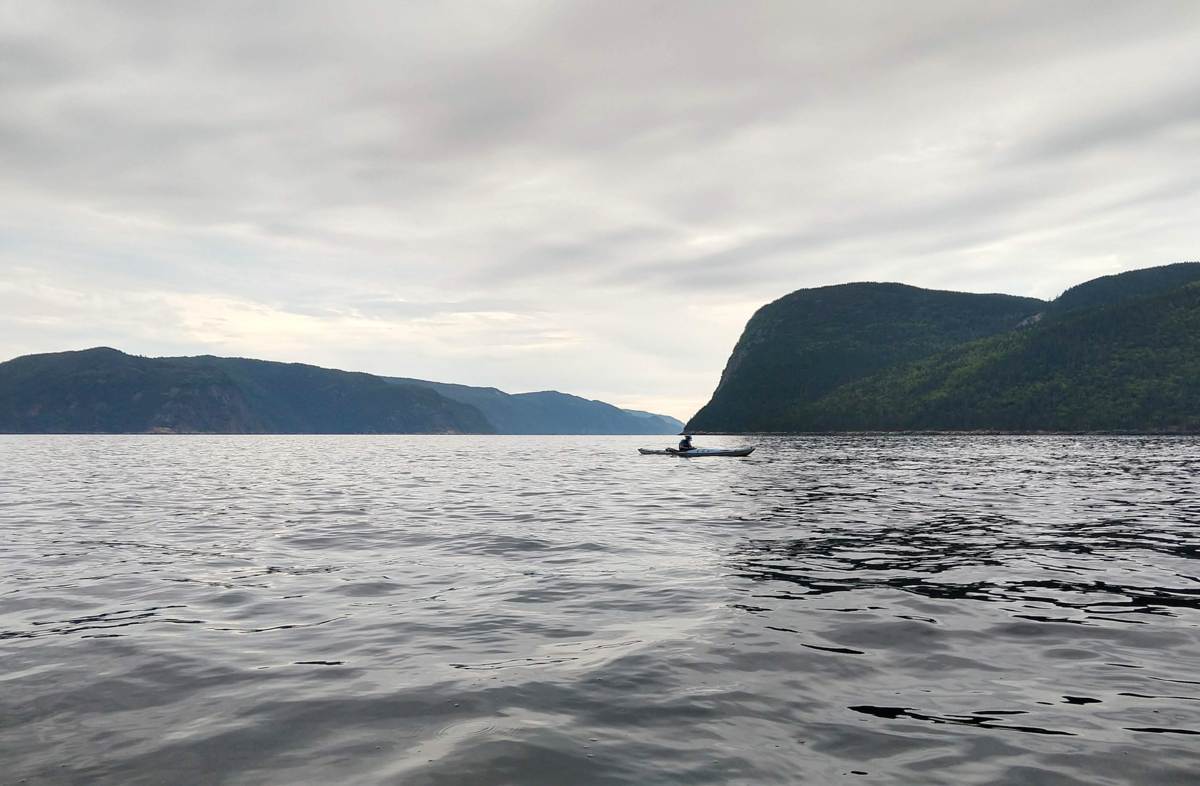
My early experiences of the bay were from shore: Holbrook Island, Fort Point, Sears Island, Moose Point, and the Belfast waterfront all provided unique outlooks on the bay. And then I started kayaking, and new worlds of possibility opened up.
The Muscle Ridge Islands, Sheep, and Monroe, Lime and Lasell, Mark Island and Robinson Rock, Islesboro, Flat, Seal, and Ram, Turtle Head, Sears Island, Butter, Great Spruce, Hardhead, and Eagle — these are just a few of the places that have become as familiar as good friends. I feel extremely privileged to have spent the better part or the last fifteen summers paddling — and leading kayak trips — along miles and miles of shoreline and out to the no-two-alike islands of our world-renowned Penobscot Bay.
People do come from all over the world to visit our bay. And, although they take lodging in our towns and spend money in our shops, make no mistake, it is the bay they come for. They come for its beauty. The come for its uniqueness. They come for its quiet.
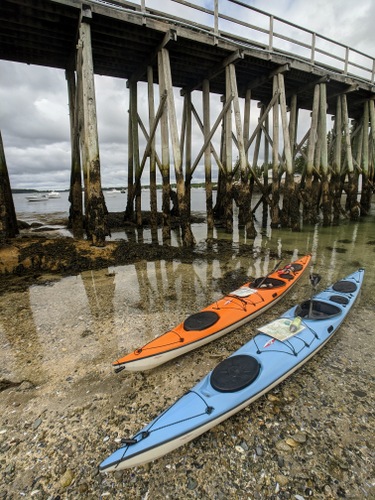
Water Walker Sea Kayak, LLC is just one among scores of businesses from Port Clyde to Stonington — kayak outfitters, sailing charters, tour boats, fishing charters, water taxis — that get people out on the water — and help keep our hotels and restaurants full.
The way the bay supports our economy can be likened to a three-legged stool. Recreation is one leg. Fishing is another. Both are highly dependent on the continued health of the bay — the health of the web of organisms, from sea ducks to seals to starfish, that call the bay their home.
The third leg of the stool, the shipping industry, has thus far been able to coexist remarkably well with recreation and fishing.
At present, the three legs of the stool are in a marvelous but somewhat delicate state of balance. Leaning on any leg at the expense of the others could tip the balance to the point that life as we know it will go crashing down.

The proposed propane tank in Searsport, the related public safety concerns, the requisite harbor dredging, the introduction of supership traffic to the bay, and the increase of truck traffic to Route 1 — together these have potential to tip the balance toward industry by irreparably harming both fishing and tourism to the point that those industries all but disappear.
There is lots we don’t know about how the tank would affect Searsport and the Midcoast. There is lots we don’t know about how the tank and its attendant superships would affect other economic activities on the bay. There is lots we don’t know about how much area property values might decrease.
We do know that ships would be significantly larger than anything that currently visits Searsport — and that each would arrive with its own moving security zone. We know that the proposed tank would be significantly larger than the existing tanks at Mack Point. We know that the tank would be visible, by land and by sea, from hundreds of vantage points for miles and miles away.
For tourists, the way a town presents itself visually makes the difference between whether they stop and visit or drive on by. Searsport can certainly do better than become known as “the town with a tank in it.”
We know that in an area where tourism and residential real estate make up a huge portion of the economy, perception IS reality — and that, if people perceive an area is undesirable because of visual pollution and hazardous materials, well, then, it is.
We know that when they reach Augusta, tourists choose between continuing north via Route 3, Belfast, Searsport, and Bucksport or staying on the interstate until they reach Bangor.
We know that for Penobscot Bay fishermen the line between thriving and not surviving is a fine line indeed. We know that recreation on the bay has huge yet untapped potential.
We know that the proposed tank will create twelve jobs. Twelve. We know that some in Searsport are already trying to sell their houses — for fear of the tank. We know that the tank issue has threatened to drive a wedge through that community — and that saying hello to DCP Midstream will result in saying goodbye to others.
We know that the pristine beauty of our bay is a treasure that will only become a more valuable and more sought after resource as time goes on. We know we can say, “No,” this once — and there will be plenty of other, more appropriate and less risky opportunities for economic development in our future.
“The largest recorded snowflake was 15 inches wide.” -Mirror.uk
Apparently, a cubic foot of snow contains about a billion snow crystals. A million billion snowflakes fall to the earth each year — and, according to an MSNBC article, scientists now believe that there is a strong mathematical probability that there are two snowflakes alike. Good luck in finding them though.
I’ve been reading up on snow a bit lately. Why not? It certainly seems like it’s going to stick around for a while. Not that I’m complaining. I’d just as soon keep a good solid snow cover until mud-season, at least.
Who can remember a January in recent years without a thaw? I can’t. According to USA Today, Bangor had 27.7 inchesl last month; or about 10 inches more than normal.
Sugarloaf USA claims a base depth of 40 to 80 inches and the best skiing in years. Parts of the Western Maine mountains region have more than 50 inches of natural snow.
If you’ve never tried cross country skiing or snowshoeing, it’s a great year to get started. If you have kids, be sure to check out the Winterkids Program, which provides discounts on skiing, boarding, skating, and snowshoeing at locations throughout the state.
One of my favorite excursions in the last few weeks was an afternoon exploring the Ducktrap River Preserve Backcountry Ski Trail, which is accessed off the Ducktrap Preserve north of Route 52 in Lincolnville.
The first mile or so of this 5.6 mile loop trail loosely follows the Ducktrap River northwest from Route 52. The “backcountry” section of the trail begins with a sharp left turn off the main trail, which at that point is a shared snowmobile and ski trail. The narrow backcountry winds over challenging terrain before descending to the bridge over the Ducktrap River. From there, the trail rises and curves past an upland clearing before descending to cross a second well-built bridge. After the bridge it is a short distance to the loop section of the trail which rises to a nice hardwood ridge.
The Coastal Mountains Land Trust describes this area on their website:
“The Ducktrap River Watershed is an extraordinary natural treasure and conservation opportunity. Located midway between the rapidly developing Camden and Belfast areas, the Ducktrap River runs for more than nine miles through wetlands and forests that are still undeveloped, quiet, and rich in wildlife and scenic vignettes of a wild landscape. The pristine habitat for spawning and young salmon make it one of only eight rivers in the United States that continue to support wild Atlantic salmon.”
Get out there and see it! You’ll be glad you did.
Resources:
 While technology increasingly aims the world smaller and tamer, there are plenty of people who go out of their way in search of the arduous and wild. People going on unique and amazing adventures, some of which you can read about at Explorersweb, were hardly in short supply in 2008.
After reading accounts of adventures on Explorersweb and elsewhere, I’d like to nominate Erden Eruc’s solo row across the Pacific Ocean as the Human-Powered Adventure of the Year in 2008.
After departing from Bodega Bay, California on July 10, 2007, Eruc rowed for 312 days during which he traveled well more than the 5514 mile straight-line distance between there and Papua, New Guinea, where he finally got out of his boat in May of last year.
Eruc’s 312 days at sea set a new world record for the longest duration ocean row. Eruc also became only the 4th person to row the Pacific from east to west.
For the sake of contrast, I’ll mention that more than 4.000 individuals have climbed Mount Everest. The number of ocean rowers to successfully cross an ocean is about 350.
While on his trip, Eruk conducted teleconferences with 20 different schools around the world, sent out 130 news dispatches, typed 2400 emails, produced 30 cassettes of high def video, raised $12,000 raised for charity, hosted a growing menagie of winged stowaways, and somehow maintained good spirits and a sense of humor.
Maintaining his boat and gear without relying on outside help and supplies presented major challenges. At one point, the sliding seat he depended on for each oar-stroke broke and become inoperable. After a lot of thought, ingenuity, and rummaging, he was able to repair it.
One frightening moment came when a rogue wave hit the boat on a winter night, capsizing it and throwing Eruk to the ceiling. The 23-foot boat was designed to be self-righting — and true to form it righted itself soon afterward.
Adverse winds and an oncoming storm season forced Eruc to suspend his trip before reaching Australia, but he plans to resume the trip, starting in Papua, New Guinea, this spring.
For Eruc, the Pacific row is just the first leg of a muscle-powered solo round the world journey. His website lists the remaining legs as follows:
* resume his circumnavigation by returning to the Papua New Guinea waters, to eventually reach Australia, (Stage 2)
* approach Mt. Kosciuszko by bicycle and climb it,
* bicycle to Fremantle on Australia’s west coast,
* row from Fremantle to India, bicycle to Nepal, climb Everest (highest point),
* bicycle to Elbrus in Russia at its border with Georgia and climb it,
* bicycle through Georgia, Turkey, Syria to Jordan to touch the Dead Sea (lowest point),
* continue on to Tanzania by bicycle and climb Kilimanjaro,
* bicycle to Namibia, then row to Brazil,
* bicycle to Argentina to climb Aconcagua,
* return to Bodega Bay near San Francisco to conclude the human powered circumnavigation, then continue on by bicycle to Seattle.
Kinda puts that daily subzero-weather trip out t0 the the mailbox in into a little different perspective.
To read more about Erden Eruc and his ocean row see:
–Around-n-over
–Best of ExplorersWeb 2008 Awards: The longest row, Erden Eruc
–One Man’s Goal: To Travel Around the World on His Own Power
As both a kayak guide and an educator, I felt fortunate to be one of several hundred attendees at the Governor’s Conference on Youth and the Natural World at the Augusta last Thursday.
The gist of the conference was this: (1) young people today don’t spend enough time outdoors; (2) correcting this problem will have important benefits to young people and is likely crucial to the survival of our society.
Governor Baldacci introduced the conference and spoke of his own recent experiences paddling the Allagash and climbing Mt. Katahdin with his son. “Believe me, if I can do it, anyone an do it.” he stated, possibly alluding to the fact that he does not consider himself an outdoorsman or one who pays much attention to his level of physical fitness.
Larry Selzer, President of The Conservation Fund and a leader of the national take-it-outside movement, described the current situation (unhealthy kids, unhealthy environment), as well as proposed solutions that range from parents spending more outside with their kids to redesigning schools as a means of “bringing nature to kids.”
Among the factoids Selzer provided were the following: On the increasing popularity of computers and gaming technology: “The most common injury in children 8 – 15 is no longer broken bones but repetitive motion disorder.”
On over-medication of kids: “Children who have exposure to nature for [even] 10 minutes a day need less medication.”
Selzer mentioned the biophilia hypothesis, which states that we are all biologically wired as hunter / gatherers and therefore need at least occasional immersion in the natural world to be physically and psychologically healthy.
An additional concern of Selzer and groups such as The Conservation Fund (of which he is director) is that it is unlikely the next generation will be stewards of the natural environment if spending time in nature has not been an important part of their lives. And the problem could even get worse, as projections indicate that by 2050, 85% of Americans will live in cities.
Selzer and others at the conference, including David Hales, College of the Atlantic President, and Mitchell Thomashow, Unity College President, spoke of the need to include environmental literacy as a goal for public education. (Designers of the new Maine Learning Results, are you listening?) Several groups, including the Maine Environmental Education Network, are working on identifying the benchmarks of this new type of literacy.
According to Mitch Thomashow, the purpose of education needs to be expanded to be something that not only “gets people to think about how one learns, but also how one lives.”
“Another world is not only possible, she is on her way. On a quiet day, I can hear her breathing.” –Arundhati Roy
Resources:
Campaign for Environmental Literacy

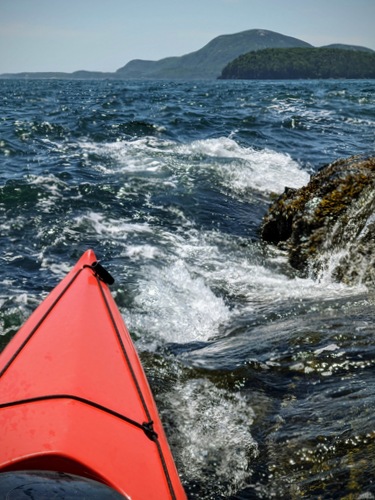
The carbon/kevlar layup of my Ruahine Swallow multisport kayak is very thin, and while I’ve managed to keep it off the rocks so far, it felt like I would be pushing my luck to continue to paddle it down through Class II and Class III rapids without adding a little extra protection.
A keel strip was the obvious solution. But then I read about using a rubberized truck bed coating such as Arma Coatings. Searching Paddling.net for more information on the topic, I came across a useful thread. Rather than get a commercial application, I decided to purchase a product called Durabak 18 on eBay from a company called Newlinesafety.com. The folks at Newlinesafety were very helpful in helping me chose the right product (smooth rather than textured) for this application and even warned their product would create a small amount of drag.
With that warning in mind, I decided to apply a very narrow strip in my initial application. I figure I can always go back and widen the band of Durabak as my kayak hull begins to show more wear.
Durabak can be purchased in quart sized containers. My cost, including shipping, was about $50.00. The company warns that once opened and exposed to air, the product hardens rapidly. I resealed it the best I could. If I don’t get any further use out of that quart, the cost will likely be more than $1.00 per square inch. But it was easy to apply — and if it creates some good karma as I rock’n roll my way down the river, it will have been worth it.
Too much time on the web lately. Too little time on the water! I’ve been working on a few website design projects including a redesign of the MaCKRO website.
Just over 5 weeks until we put our paddles in the water under the bridge at the start of the annual St. George River Race.
 1. Stand-In Point, on the western tip of North Haven, a 9 mile crossing from Camden Harbor.
2. Ocean surf on the ledges south of Hurricane Island.
3. Along the shore of Little Hurricane Island, looking north toward the White Islands.
4. Mark Island, last stop before making the 4.6 mile return crossing to Camden Harbor.


