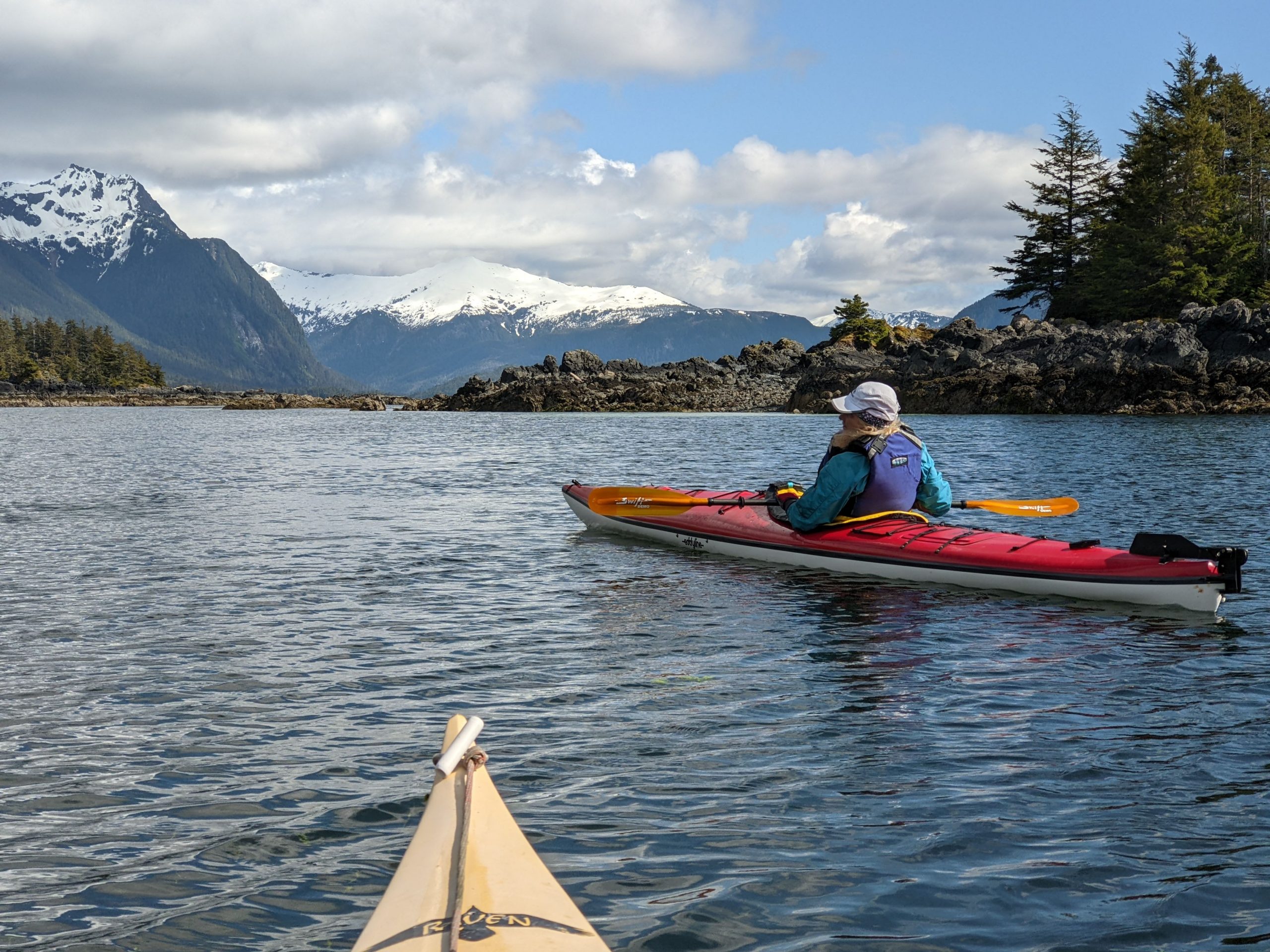
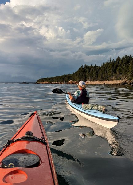
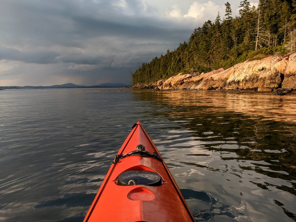
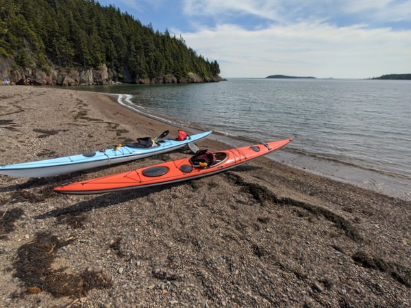
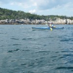
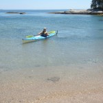
A photo from our recent paddling adventures in Sitka, Alaska.
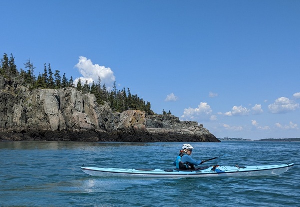
Our tour offerings are greatly expanded this summer — in hopes you’ll tour more with us. In addition, our website has been re-organized so that it is now either to search for kayak tours by date or by geographical area.
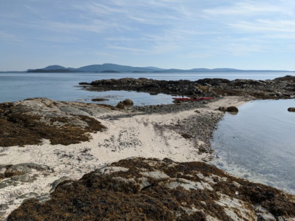
You can now search for our sea kayak tours in the areas of Rockland (including Muscle Ridge), Belfast, Stonington, Schoodic (including Acadia National Park / Mount Desert Island), and Jonesport.
If the dates of our scheduled tours don’t work for you, please contact us as we still have many open dates and are eager to provide custom tours.
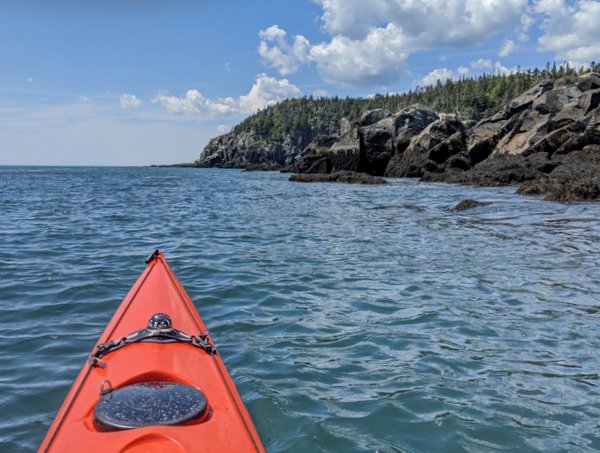
Our July coastal Maine sea kayaking trips have featured Frenchmen’s Bay south of Sorrento, the archipelago of islands south of Cape Split (South Addison), and the Bold Coast near Lubec / Quoddy Head State Park.
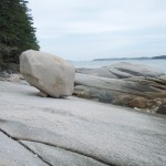
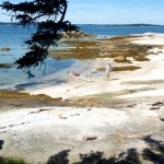
If you were to view the Baker Island Dance Floor through the lens of a time-lapse camera, you would see that there is a dance going on — one that has taken place over centuries.
Calm bright summer days bring a relative flurry of activity. The dancers most often arrive quietly, in small groups. Mixed among them are those who will only sit. There are, however, usually a few who will dance. They feel the wind, scan the horizon, and listen to the waves breaking on the rocks — as if to internalize the rhythm; and then, although no band is playing, they pantomime a few steps. Sometimes it is a solitary person who rises and stands in the sunlight on that shelf of brilliant pink granite, at the brink of the broad Atlantic, who then steps out an impromptu waltz with the sea.
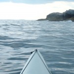
By the time you reach there, you have crossed four miles of ocean. Perhaps the seas have been rough. Maybe your passage through the Cranberry Islands has been slowed by fog. After landing your boat on the rocky shore and clambering up through the sea weed zone, you hike for twenty minutes — up through the meadow, past the old farmhouse, to the lighthouse and then down a narrow trail that at times seems to go nowhere, and then you arrive at this place to which people have been coming for hundreds of years for picnics and dancing.
The dance floor is what you have come for. Photos don’t do it justice. You have come a long way for this and have probably been to many granite shorelines in your time, so you come with some skepticism that this will be anything special. And then the trail opens out to the dance floor and you forget all of that. It’s a lonely place, an awe-inspiring place, a wild place. You feel like you are on the edge of something — and you are. Sky, rock, and sea dwarf all that is human, including human thought. You get pushed out of yourself. It’s hard to know what to do. At the dance floor, the suggested activity is to dance.
Some who arrive there do so as a result of being lured by the brief description under “Unique Natural Features” in the Delorme Atlas. Some learn about it by reading kayaking or cruising books. Others come via boat tours out of Northeast Harbor. Still others come as part of organized groups. Penobscot Paddles describes their own recent trip to the Baker Island Dance Floor in their blog here. Ten years ago, a group of 26 social dancers gathered there for a dance that was recorded in a series of photos. Read about it and view the photos at http://www.cranberryisles.com/baker/dance.html The 2001 event was a re-enactment of sorts of events in the 1800’s, when Cranberry Islanders first began using Baker Island for picnics and dancing.
It wouldn’t surprise me to learn that Native Americans did some dancing there as well.
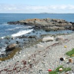
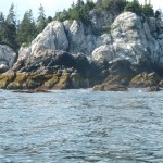
Baker Island is about four miles south of Mt. Desert Island and is the outermost of the five islands that make up the Cranberry Isles. Settlers were living on the Cranberry Isles by the early 1760’s. The island has a 43-foot lighthouse situated at its center that is now nearly obscured by trees.
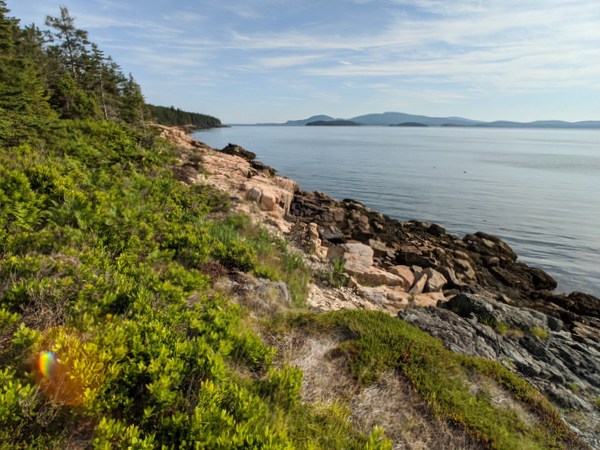
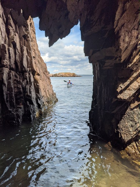
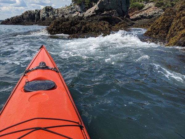
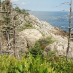
The southern tip of Isle au Haut, between the rocky islets of Eastern and Western Ear, is an otherworldly place of rock, ocean, and sky. Along with the southern shores of Monhegan, Matinicus, Schoodic, and Great Wass, it is among the most exposed places on the Maine coast. Kayaking this remote stretch of coastline is not for the untrained or faint-hearted.
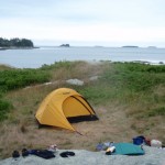
Sea conditions last Saturday (July 30) were settled enough for us to give it a try, and try we did. On the day before, we had paddled out of Stonington under grey and somewhat ominous-looking skies. We dodged south around Scott, Green, and St. Helena Islands, seeking protection from the stiff headwind when we could find it. Steve’s Island, a favorite, was occupied by a group of kayakers, so we pushed another mile across Merchant Row to Harbor Island, a BPL Island that is also part of the Maine Island Trail, where we set up camp for the night. After a night full of rain and wind, we set off the next morning for a 20-mile circumnavigation of Isle au Haut.
As we paddled south between Burnt Island and Isle au Haut, the fog thinned, the wind eased, and our spirits lifted. The forecasted day of blue skies and light and variable winds seemed to be materializing after all. The winds from the night before were still present in the form of a storm swell that rhythmically rolled in on us from the east.
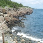
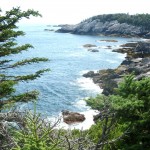
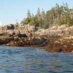
The eastern coastline of Isle au Haut is cliff-lined, rocky, and varied. Well-maintained homes and estates are interspersed along its shores. A procession of ledges and islands line the horizon to the east. These ledges and islands provided welcome protection from the storm swell. As we neared the high cliffs of Eastern Head, swells were converging from two directions — from the southeast and the southwest — making for confused sea conditions and difficult paddling.
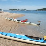
“Sure Thing!” Setting off from Stonington Harbor
View to the northwest from Harbor Island
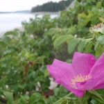
Wild roses on Harbor Island
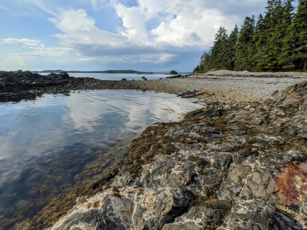
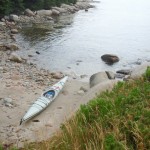
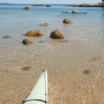
Gravel beach at Harbor Island
Mt. Champlain on Isle au Haut rises in the distance.
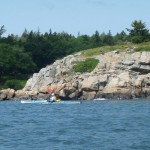
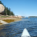
Paddling along the cliffs of Eastern Isle au Haut.
Isle au Haut, eastern shoreline
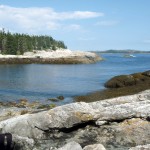
Isle au Haut, southern coastline
Cove on the southern coast of Isle au Haut
Rocky shoreline along the western shore of Isle au Haut.
Rounding the basalt cliffs of Western Ear.
Cliffs of Western Head, Isle au Haut
From along the trail southwest toward Western Head
Cliffs of Western Ear, Isle au Haut
Coastline of western Isle au Haut
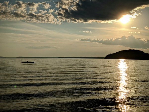
Sunset near Hardwood Island
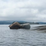
near McGlathery Island
The southern coast of Isle au Haut
We shot the passage between Eastern Head and Eastern Ear. Swells whose crests rose above our heads raced toward us. Powered by adrenaline, we dug our paddles in and pushed up over the wave crests. With0ut a doubt, rounding the southern part of Eastern Ear was the most challenging part of the trip.
The seas there were steep-sided, confused, and — counting the refracting waves off the cliffs — now coming from three directions at once. Occasional guillemots marked the water. Occasional lobster boats marked the horizon. Other than that, it was just the two of us, the distant cliffs, and the big sea. Out there, in that wild and foreign environment, the smell of the sea sharp in your nose, the sunlight bright in your eyes, and the swells lifting under you, the very planet seems to palpitate, to hum, and to roar. Your senses are so wide awake, it is as if you can hear the earth’s heartbeat — and your own heartbeat too.
The southern coast of Isle au Haut
We stayed far offshore to minimize the effects of the refracting waves and paddled steadily across Head Harbor, looking for a beach where we might land or a shoreline where we might get some relief from the waves. By this time, the seas seemed less dangerous, but paddling still required our full attention. A moment of inattention and a capsize in these cold waters was not something we wanted to deal with.
At last, we made our way west-northwest into a somewhat protected cove and landed on a rough cobbled beach.
After lunch and a short hike along the shoreline cliffs, we launched our kayaks and paddled around Western Head. By then, the winds had calmed and the storm swell had diminished. The waves out of the southwest were still large enough to keep us from getting too close to the cliffs. The tide was too low to allow us to shoot the passage between Western Head and Western Ear, so we rounded the ear and turned north into progressively calmer conditions.
The afternoon light dramatically highlighted the cliffs of the wild shoreline north of Western Ear. We paddled on happily, feeling assured that the most difficult conditions of the day were behind us. The sky was blue; the sun was friendly and warm. We loitered among the ledges, watching seabirds, taking photos, and gazing at the cliffs.
We paddled into Duck Harbor to replenish our water bottles and quickly check out the campground, which I had not visited in several years.
As we moved north from Duck Harbor, we felt both a sense of haste (the day was waning) and leisure (the light was beautiful, the water was calm and increasingly glassy).
We crossed past the western edge of Kimball Island, paddled east along Kimball Head, and then swung north toward the southern shoreline of Merchant Island. The subtle “huff” of a harbor porpoise is something I heard several times without being able to confirm it. And then we started to see them, repeatedly breaching the quiet water as they worked the ledges for fish. We spent a entranced half an hour moving among the breaching porpoises while they moved around us.
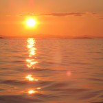
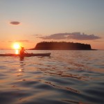
By now the sun was nearing the horizon. It was time to make a push for our campsite on Harbor Island. We rounded the western shore of Merchant, paused to watch the sunset, and then returned, tired, hungry, and happy to our campsite.
The kayaker launched from Hancock Point and was found near Hulls Cove. His kayak was found further south near the Porcupine Islands.In a tragic accident during a honeymoon trip, a kayaker died of accidental drowning in the waters of Frenchman Bay last Sunday.
The purpose of this blog post is not to judge the decisions made by this kayaker or to determine exactly what happened but rather to learn from the incident so that other kayakers can avoid this type of accident in the future.
Sunday, June 19 dawned brilliantly sunny and clear. Visibility was a near perfect 10 miles. The 7:00 a.m. air temperature was listed at 59 degrees. The surface water temperature in Frenchman Bay was 58 degrees.
The young man involved in the incident, Eric Hogan, 28, of Webster, Massachusetts, left the shore of Hancock Point in a sit-on-top kayak, wearing only shorts and a life jacket. The lightness of his attire together with the reported fact that he and his wife were planning to leave their vacation cottage that day, seem to indicate that he only planned a short trip. The perfect visibility must have made the mountains of Acadia appear almost close enough to touch.
Waking up in Belfast that morning, I noted the stiff wind blowing and immediately decided that, for me, it was likely not a paddling day. However, weather records in the Bar Harbor area indicate winds of less than 10 mph at 7:00 a.m. The wind direction was from the WNW, which means if he launched from the east side of Hancock Point, he would have been in the lee of the wind and might not have felt it until he had paddled away from the shore. Even if he launched from the southern end of Hancock Point, he may not have been fully aware of the sea conditions, since — when looking out over the water — it is easy to underestimate waves that are not breaking straight onto the shore.
Low tide on Sunday morning was at 8:08 a.m. The tide is listed as 0.5 feet below “normal,” meaning it was a lower than average tide. At 7:00 AM, the tidal currents when move in and out of Frenchman Bay were nearly slack. Although there would be no clouds or rain that day, that early morning stillness was truly “the calm before the storm.”
By 8:15 a.m., the wind was coming out of the northwest. This may have pushed the kayaker further offshore and made it more difficult for him to return. Average wind speed increased to 12 mph, with gusts up to 21 mph. At shortly after 9:15 a.m., wind gusts of up to 25 mph were recorded in Bar Harbor. By this time the tidal currents that push north up the bay and ultimately west through the Mount Desert Narrows would have begun to increase. When tidal currents are in direct opposition to waves, as they were this day, it results in a rough steep-sided seas. By this time, wave heights at the Eastern Maine Shelf Buoy south of Mount Desert Island had increased from 3.0 to 3.8 feet.
Likely sometime between 9:00 and 11:00 a.m., Eric Hogan’s kayak was capsized and he was not able to get back aboard. Perhaps it had already capsized several times. One feature of sit-on-top kayaks is that unlike standard (“sit-in”) kayaks, they do not take and water and cannot swamp. Following a sit-on-top capsize, a paddler need only flip the kayak upright, clamber back aboard, and resume paddling.
The combination of the wind and wind-blow spray as well as the waves sloshing up onto his kayak undoubtedly started to lower Eric’s body temperature. If he had already capsized one or more times, this would have lowered his body temperature further. When the body gets cold, hands and feet start to lose dexterity. Next, arms and legs begin to lose strength. The mind also slows down. Coordination is lost. Judgement becomes clouded.
On one of the capsizes, Eric may not have been separated from his boat or paddle or both. Or, his arms may no longer have had the strength to pull himself back aboard.
At around 11 a.m., after his wife reported him overdue in returning from his outing, police and emergency response personnel began searching for him. Hogan was unresponsive when the Coast Guard found him floating off Hulls Cove around 1:30 p.m.
For the vast majority of people, kayaking is a relatively low risk sport that enhances health and provides a lot of joy. A study of paddlesport deaths in Maine shows that there were 12 kayaking deaths in the years 2000 – 2007, four of which occurred in ocean waters. However, even one death is too many. Following are some guidelines for reducing the incidence of this type of accident in the future.
1. Wear a life jacket, but also understand its limitations. Although the life jacket does not ensure survival, it does extend survival time when swimming in cold water.
2. Choose a kayak appropriate for the waters you are paddling. For paddling in cold waters, kayaks with enclosed cockpits and sealed bulkheads (provide reserve flotation in case of capsize) are recommended.
3. Leave a written float plan indicating where you are going and when you intend to return.
4. Dress for air AND water temperatures. When paddling the Maine coastline, this may mean wearing a wetsuit or dry suit. When it is summer on the land, it is still spring on the water.
5. Listen to weather forecasts. Winds of more than 12 mph may be too much for beginning paddlers. Winds of more than 18 mph may make conditions unsafe for intermediate paddlers.
6. Be prepared for changes in weather. Dramatic and unexpected weather changes will eventually affect all outdoor adventurers.
7. Study charts. Know the areas you will paddle. Understand the effects of tides and currents. Stay along shorelines as much as possible.
8. Carry a waterproof/submersible VHF radio and/or a cell phone in a waterproof pouch.
9. Practice self-rescue and assisted rescue techniques. Take a class to learn these if you have not done so.
10. Paddle in a group when possible as doing so increases your ability to successfully handle an accident or other unexpected situation.
11. If paddling alone, be more conservative in your decisions regarding all of the above
12. If you are unsure about any of the above, strongly consider going with a guide or more experienced paddler.
*Weather and sea condition data are from Gomoos.org and Wunderground.com
When John D. Rockefeller, Jr. started building the 57-mile network of carriage roads on Mount Desert Island in 1913, I am quite sure he did not have cross country skiing in mind. Long, long before that, the island’s incredibly varied geologic history, including periods of erosion and sedimentation, plate tectonics, volcanic eruption, and glaciation, shaped the dramatic landscape that we see there today.
As beautiful as Acadia National Park is during the summer, it is no less majestic in the winter. Acadia is famous for it’s juxtaposition of mountains and sea. Throw snow into the mix and you have something even more amazing.
Make it several feet of pristine white snow that stretches right down to the water’s edge, miles of groomed trails (thanks Friends of Acadia), no entrance fee, free parking, and it is probably the best cross country ski value in North America.
All those factors combine to make it a very special place for skiing.
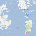
After making the drive from Belfast, we pulled into the Hull’s Cove visitors area. A ranger recommended the groomed trails in the Jordan Pond area. By that time, we were eager to minimize driving and maximize skiing, so we split the difference, drove to Eagle Lake, found a place in the nearly full parking area, and headed out along the western shore of the lake.
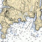
Along Eagle Lake, the trails were tracked but not groomed. Nothing to complain about for those accustomed to Waldo Country snowmobile trails, snowshoe trials, and just plain bushwacking. On the Jordan Pond section of the trail (see map below), we were treated to something seldom found in midcoast Maine: groomed tracks for both classic and skate skiing.
The tracks had iced over in the mid-afternoon shadows — it was a long sweet ride down the graded trail to Jordan Pond.
Next, still on groomed tracks, we headed down a long hill with tight turns toward Lower Hadlock Pond. The trail continued good on past Upper Hadlock Pond — and then became less groomed at some point. The winter quiet of Aunt Betty Pond was compelling, but so we were also getting increasingly hungry, tired, and cold — and eager to close our 15-mile loop by continuing on through the diminishing light back to the Eagle Lake Parking area.
Day 2 featured skiing into Sand Beach after Parking at the end of the Schooner Head Road. After skiing on the beach itself, (we are not the first to try this out), we headed out along the footpath that leads from Sand Beach to Thunder Hole and then on to Otter cliffs.