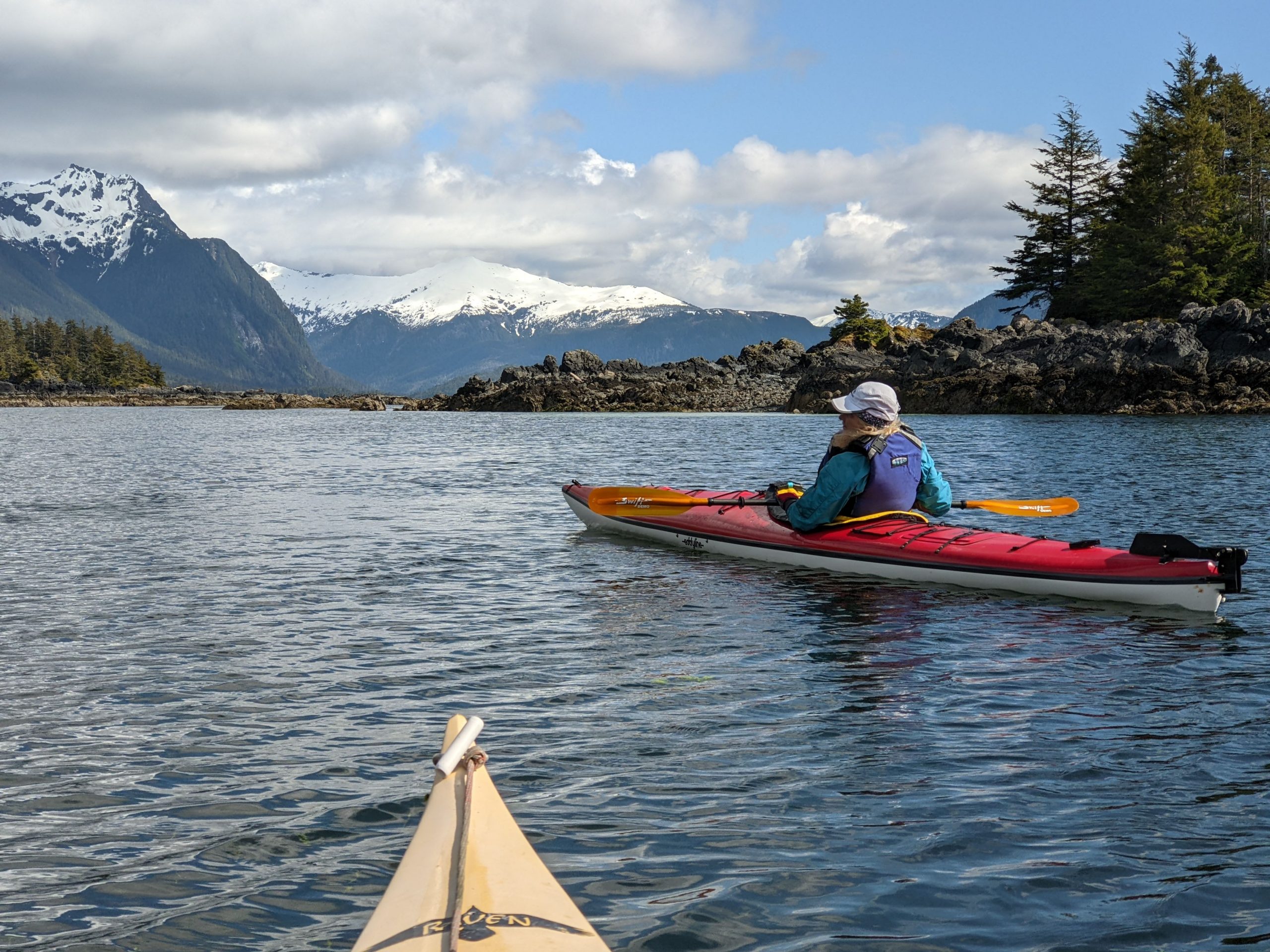
A photo from our recent paddling adventures in Sitka, Alaska.
Our tour offerings are greatly expanded this summer — in hopes you’ll tour more with us. In addition, our website has been re-organized so that it is now either to search for kayak tours by date or by geographical area.
You can now search for our sea kayak tours in the areas of Rockland (including Muscle Ridge), Belfast, Stonington, Schoodic (including Acadia National Park / Mount Desert Island), and Jonesport.
If the dates of our scheduled tours don’t work for you, please contact us as we still have many open dates and are eager to provide custom tours.
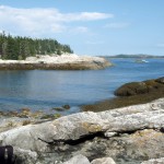
The southern tip of Isle au Haut, between the rocky islets of Eastern and Western Ear, is an otherworldly place of rock, ocean, and sky. Along with the southern shores of Monhegan, Matinicus, Schoodic, and Great Wass, it is among the most exposed places on the Maine coast. Kayaking this remote stretch of coastline is not for the untrained or faint-hearted.
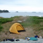
Sea conditions last Saturday (July 30) were settled enough for us to give it a try, and try we did. On the day before, we had paddled out of Stonington under grey and somewhat ominous-looking skies. We dodged south around Scott, Green, and St. Helena Islands, seeking protection from the stiff headwind when we could find it. Steve’s Island, a favorite, was occupied by a group of kayakers, so we pushed another mile across Merchant Row to Harbor Island, a BPL Island that is also part of the Maine Island Trail, where we set up camp for the night. After a night full of rain and wind, we set off the next morning for a 20-mile circumnavigation of Isle au Haut.
As we paddled south between Burnt Island and Isle au Haut, the fog thinned, the wind eased, and our spirits lifted. The forecasted day of blue skies and light and variable winds seemed to be materializing after all. The winds from the night before were still present in the form of a storm swell that rhythmically rolled in on us from the east.
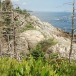
The eastern coastline of Isle au Haut is cliff-lined, rocky, and varied. Well-maintained homes and estates are interspersed along its shores. A procession of ledges and islands line the horizon to the east. These ledges and islands provided welcome protection from the storm swell. As we neared the high cliffs of Eastern Head, swells were converging from two directions — from the southeast and the southwest — making for confused sea conditions and difficult paddling.
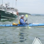
“Sure Thing!” Setting off from Stonington Harbor
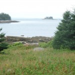
View to the northwest from Harbor Island
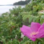
Wild roses on Harbor Island
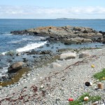
Gravel beach at Harbor Island
Mt. Champlain on Isle au Haut rises in the distance.
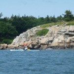
Paddling along the cliffs of Eastern Isle au Haut.
Isle au Haut, eastern shoreline
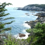
Isle au Haut, southern coastline
Cove on the southern coast of Isle au Haut
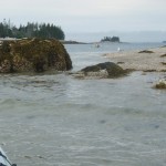
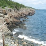
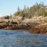
Rocky shoreline along the western shore of Isle au Haut.
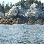
Rounding the basalt cliffs of Western Ear.
Cliffs of Western Head, Isle au Haut
From along the trail southwest toward Western Head
Cliffs of Western Ear, Isle au Haut
Coastline of western Isle au Haut
Sunset near Hardwood Island
near McGlathery Island
The southern coast of Isle au Haut
We shot the passage between Eastern Head and Eastern Ear. Swells whose crests rose above our heads raced toward us. Powered by adrenaline, we dug our paddles in and pushed up over the wave crests. With0ut a doubt, rounding the southern part of Eastern Ear was the most challenging part of the trip.
The seas there were steep-sided, confused, and — counting the refracting waves off the cliffs — now coming from three directions at once. Occasional guillemots marked the water. Occasional lobster boats marked the horizon. Other than that, it was just the two of us, the distant cliffs, and the big sea. Out there, in that wild and foreign environment, the smell of the sea sharp in your nose, the sunlight bright in your eyes, and the swells lifting under you, the very planet seems to palpitate, to hum, and to roar. Your senses are so wide awake, it is as if you can hear the earth’s heartbeat — and your own heartbeat too.
The southern coast of Isle au Haut
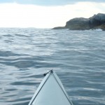
We stayed far offshore to minimize the effects of the refracting waves and paddled steadily across Head Harbor, looking for a beach where we might land or a shoreline where we might get some relief from the waves. By this time, the seas seemed less dangerous, but paddling still required our full attention. A moment of inattention and a capsize in these cold waters was not something we wanted to deal with.
At last, we made our way west-northwest into a somewhat protected cove and landed on a rough cobbled beach.
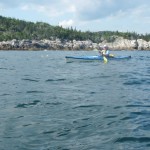
After lunch and a short hike along the shoreline cliffs, we launched our kayaks and paddled around Western Head. By then, the winds had calmed and the storm swell had diminished. The waves out of the southwest were still large enough to keep us from getting too close to the cliffs. The tide was too low to allow us to shoot the passage between Western Head and Western Ear, so we rounded the ear and turned north into progressively calmer conditions.
The afternoon light dramatically highlighted the cliffs of the wild shoreline north of Western Ear. We paddled on happily, feeling assured that the most difficult conditions of the day were behind us. The sky was blue; the sun was friendly and warm. We loitered among the ledges, watching seabirds, taking photos, and gazing at the cliffs.
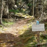
We paddled into Duck Harbor to replenish our water bottles and quickly check out the campground, which I had not visited in several years.
As we moved north from Duck Harbor, we felt both a sense of haste (the day was waning) and leisure (the light was beautiful, the water was calm and increasingly glassy).
We crossed past the western edge of Kimball Island, paddled east along Kimball Head, and then swung north toward the southern shoreline of Merchant Island. The subtle “huff” of a harbor porpoise is something I heard several times without being able to confirm it. And then we started to see them, repeatedly breaching the quiet water as they worked the ledges for fish. We spent a entranced half an hour moving among the breaching porpoises while they moved around us.
By now the sun was nearing the horizon. It was time to make a push for our campsite on Harbor Island. We rounded the western shore of Merchant, paused to watch the sunset, and then returned, tired, hungry, and happy to our campsite.
“Maine’s premiere kayaking destination,” is a way it’s been described in many places and, although I also have some other favorite places to paddle, I won’t argue with that.
Earlier this week, I guided a family group of 7 on a full day ramble among the the 65 or so islands that fill the six mile stretch of water between Stonington and Isle au Haut.
We launched from the town landing (which is tucked behind the Isle au Haut ferry terminal), weaved through moored lobster boats, and headed south across the Deer Island Thoroughfare. We paddled past Scot Island and then counterclockwise around Green Island.
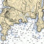
The islands here are rimmed with gorgeous glacier-scoured pink granite. Green Island offers a granite-lined cove and a quarry that makes for a great freshwater swim spot. In the late 1800’s, Green Island — as well as many other islands in this area — were quarried.
The granite cut from the islands was shipped down the east coast and used in structures such as the Boston Museum of Fine Arts, the Smithsonian Institute, several Manhattan bridges, the US Naval Academy and the Kennedy Memorial in Arlington National Cemetery. A map of quarried islands is here.
After a swim we continued south past Potato, St. Helena, and George Head Islands to little Steve’s Island, which is just short of halfway to Isle au Haut.
From Steve’s island, you can look north past spruce covered islands to Stonington. You can also look south to the 500-plus foot high Mount Champlain, the highest point on Isle au Haut. But mostly we looked at Steve’s island itself, with it’s varied rock formations, pocket beaches, clear tide pools, and sparkling emerald green waters.
After exploring Steve’s island and eating lunch there, we paddled northeast past Wreck and Bare Islands, sighting several groups of black guillemots on the crossing, before coming ashore on the gravelly beach on the southern shore of Russ Island. A 5 minute hike up a trail lined with blueberry bushes brought us to a hilltop that provides spectacular panoramic views of the archipelago.
By this time the wind had begun to pick up out of the west. We skirted the shore of Russ and Scot and hopped back to Green for another swim before returning to the town landing in Stonington.
For anyone interested in exploring these islands by kayak, we still have space available on our Deer Isle Sampler Kayak Tour on Sunday, July 6. The tour is suited to both beginning and experienced paddlers. Those who bring their own kayaks receive a discount.
If you are interested in exploring this area on your own, make sure you have adequate equipment, skills, and knowledge to ensure your own safety. Conditions can change rapidly. Fog and the numerous islands can make it easy to get disoriented, so chart and compass — along with the usual safety items such as kayak with bulkheads, bilge pump, paddle float, flares, spare clothing, weather radio, and signal horn — are essential.


