Every Kenduskeag is unlike any other, and this year will be no different.
The depth and flow rate of the Kenduskeag Stream will be lower than average for this time of year, yet there will still be plenty of water. Meanwhile temperatures in Bangor are expected to reach 57 degrees on Saturday, and absent any recent snow melt, water temperatures should be a little warmer than average as well. The biggest standout factor may be the number of paddlers. The fact that this is the race’s 50th anniversary together with the expected warm spring day should help bring in a big field. We would need close to 1600 paddlers to break the record.
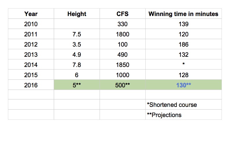
As of Wednesday, April 13, the Kenduskeag is running at about 1000 cfs (cubic feet per second) which is just about average for this date. However, with no additional rainfall expected before race day and no contributing snow melt, the flow rate is likely to drop to somewhere near 500 cfs by Saturday.
While 500 cfs is a whole lot less water than 1,000 cfs, the good news is that the level will be well above the dismally low 100 cfs we had for the hull-sanding event that constituted the 2012 race.
Kenduskeag Stream Canoe Race data 2010 – 2015, with projections for 2016.
Robert Lang’s course record of 1:50.08 is safe for another year, but this year’s winning time should easily be closer to two hours than to the three hour plus slog we saw in 2012. (See chart on left). Based on plotting winnings times and stream flow since 2010, I am projecting a winning time of 2 hours and 10 minutes for this year’s race.
Want more predictions? How about that there will be at least one big surprise in the top 10 overall, that at least one craft will capsize before the start, that more than a hundred craft will capsize at Six Mile Falls,, and that there will be a lot of smiles at the finish.
The wildwater boat is sometimes viewed as a specialty boat, but in many ways it is more versatile than most of the boats on the market. Imagine you wanted to combine the speed of a surf ski, the buoyancy of a creek boat, the turning ability of a slalom boat, and the toughness of a whitewater boat. The wildwater kayak is what you would end up with.
According to the United States Canoe Association, wildwater kayaks have a maximum length of 4.5 meters (14 feet 9 3/16 inches). Rules prohibit wildwater kayaks from having rudders. Other than that, the design of kayaks used for wildwater is open. Most modern wildwater kayaks, however, are narrower than 20 inches at waterline and have considerable above-waterline reserve buoyancy. Much of the reserve buoyancy is in the “wings” that flare out just aft of the cockpit.
Two examples of high end composite wildwater kayaks from Zastera are below:
The Zastera Corvette
The Zastera Aggressor
Those just getting into the sport can start with just about any durable kayak (yes, you will mix it up with rocks) that is 14’9″ or shorter. The Perception Wavehopper (discontinued in the U.S. but available used) and the Pyranha Speeder are reasonably fast polyethylene kayaks well suited for wildwater racing on Class I, II, and III whitewater.
Wildwater Kayaks are fast due to their narrowness. Their narrowness makes them “twitchy.” Their twitchiness makes them a challenge. Never a dull moment in a wildwater boat. In the unlikely event you start experiencing those kinds of moments, time to get a narrower boat.
Wildwater Kayaking is part of the Penobscot River Nationals Regatta on Maine’s Penobscot River in July 2016. The event is open to wildwater racers of all experience levels, and paddlers are at least as friendly as they are competitive. Come and join the fun!
From my biased perspective, it’s hard to understand why wildwater kayaking is not more popular.
Wildwater kayaking gets you outside, provides adventure, and takes you to beautiful natural places.
Wildwater provides similar cardiovascular benefits as sports such as running, bicycling, and surf ski racing.
Photo from WWKC.net
At the same time, wildwater provides the same rush of that can be found in sports such as downhill skiing, snowboarding, and whitewater playboating.
In addition, like golf or tennis, wildwater is a thinking person’s sport that rewards experience, knowledge, and technique.
One trend in paddlesports is the “first descent” — elite paddlers racking up air miles in order to take on never-before-paddled stretches of whitewater in Africa, Asia, or South America — and expending increasingly huge amounts of resources as they do so.
Many local paddlers follow the same pattern but on a smaller scale. As they master local rivers, they are forced to drive farther from home to again experience the level of challenge and exhilaration they used to get from rivers closer to home.
Wildwater paddling is an antidote to this problem. Imagine spending months or years paddling the same local river but in progressively narrower and tippier boats. Imagine that each time you race that same river, you are looking to run better lines and to cut seconds off your previous best time.
If a quest for improvement that draws on cardiovascular fitness, strength, technique, ability to read the water, and knowledge of particular rivers is appealing, wildwater racing could be for you.
A couple of resources for learning more about wildwater racing include:
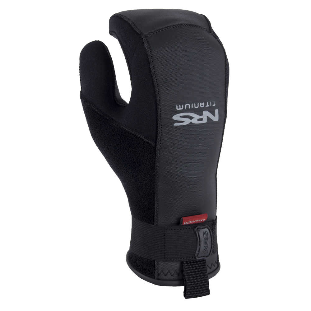
NRS Toaster mitts are not a new product. In fact, they have been around for a long time and are now listed as an NRS closeout, but they are new to me.
I’ve been paddling with Toaster Mitts since November and am thrilled with the level of comfort they bring to my previously wet and cold hands.
Previous to using Toaster Mitts, I was an enthusiastic pogie user. (This is the point in my blog where I may be losing my non-kayaking readers. ‘What’s a pogie?’ They might well ask.) Enthusiastic, yes. After all, pogies are a world above neoprene paddling gloves — both in terms of providing a firm grip on the paddle and maintaining a level of comfort for the hands.
Pogies, as I learned over time, do have a number of shortcomings: (1) once pogies get wet, they are, well, wet — and so are your hands; (2) if you paddle in waves or whitewater, your pogies will get wet; (3) if you paddle with a wing or a Greenland paddle (think no drip rings) your pogies will, see above, get wet; (4) in the event of capsize or when going ashore, once you take your hand off your paddle, your pogies are no longer with you.
The NRS Toaster mitt is a fuzzy-lined neoprene mitten shaped to curve around your paddle shaft and fit snugly around your wrist, and with enough texture to provide a good grip on your paddle. The thickness is just right. Thin enough to provide a feel for the paddle shaft. Thick enough to provide warmth. NRS provides a fit chart and guidelines to measuring your hand so the right fit is assured when ordered online. They come on and off more quickly than a pogie as well.
And they stay dry.
I’ve used mine in temps approaching up to 50 degrees and down into the upper 20’s. I expect I’ll be using them for the first races of the
whitewater series this spring.’
The NRS Toaster Mitt is now on sale for $33.75 at NRS. I like them so much I ordered a second pair. Get them before they are gone!
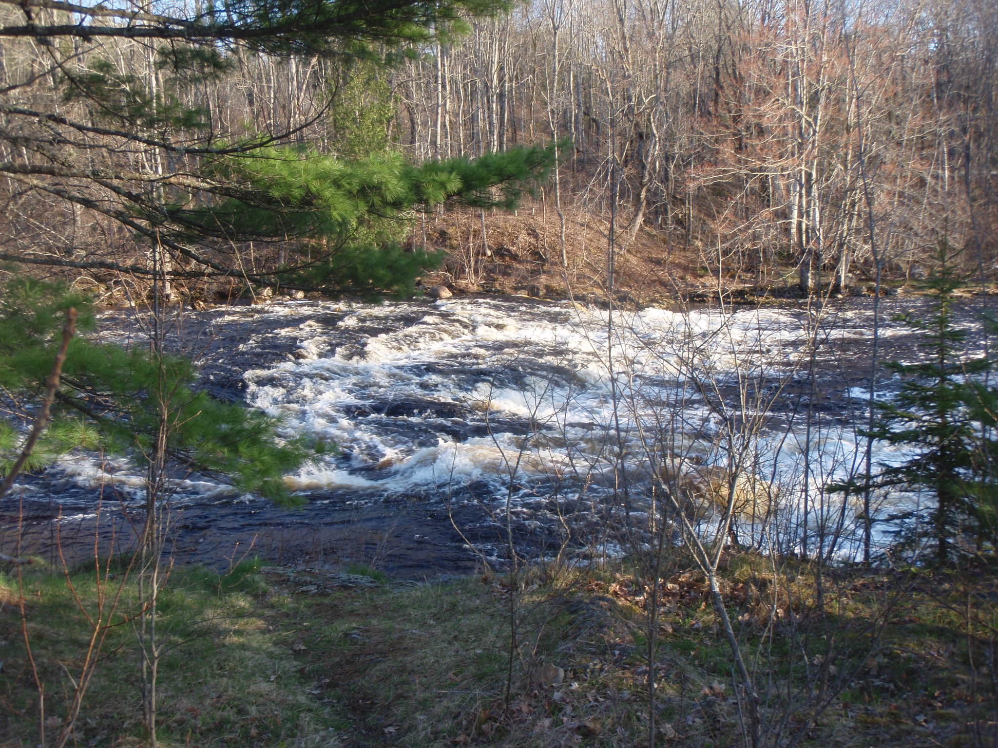
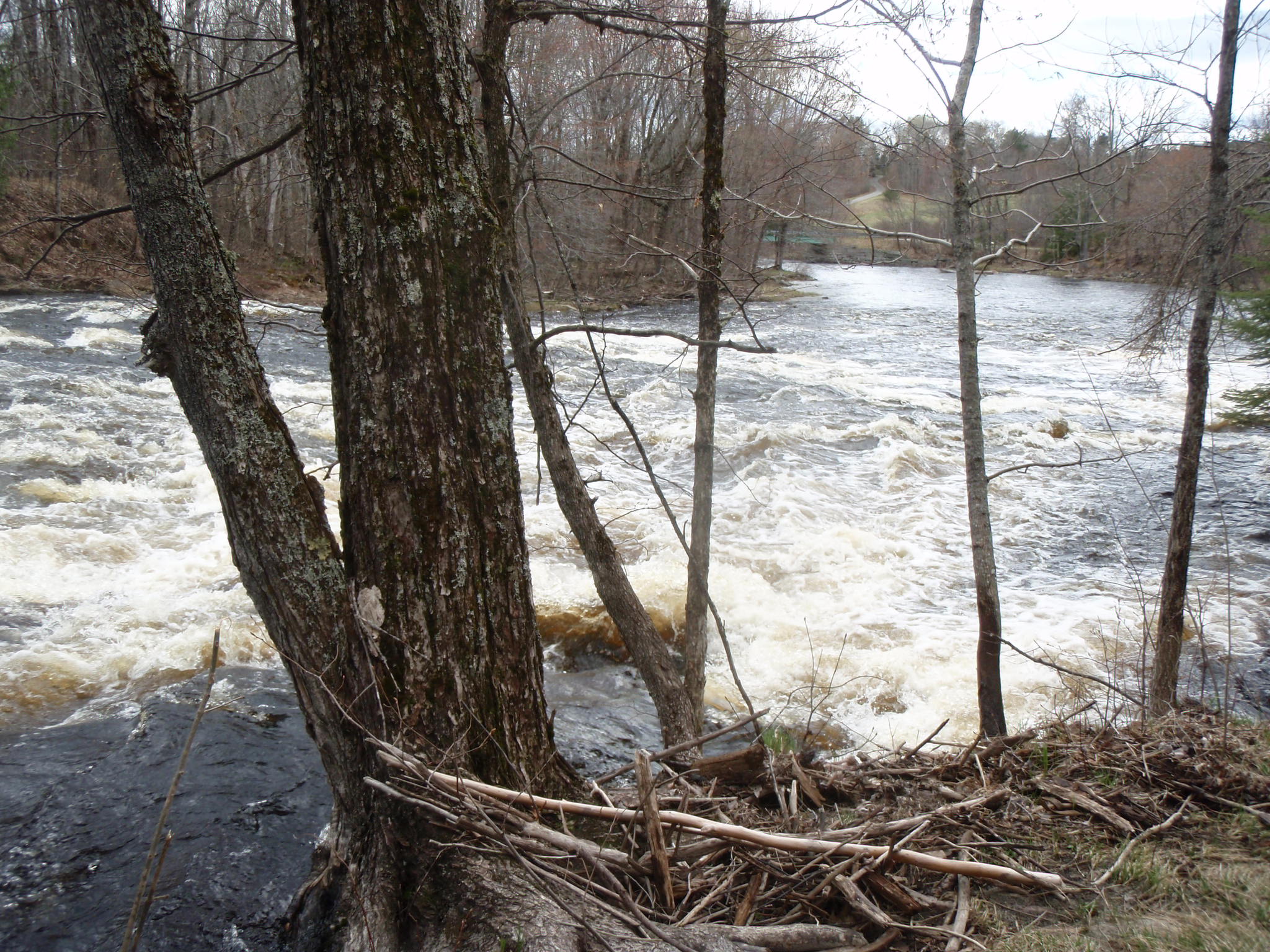
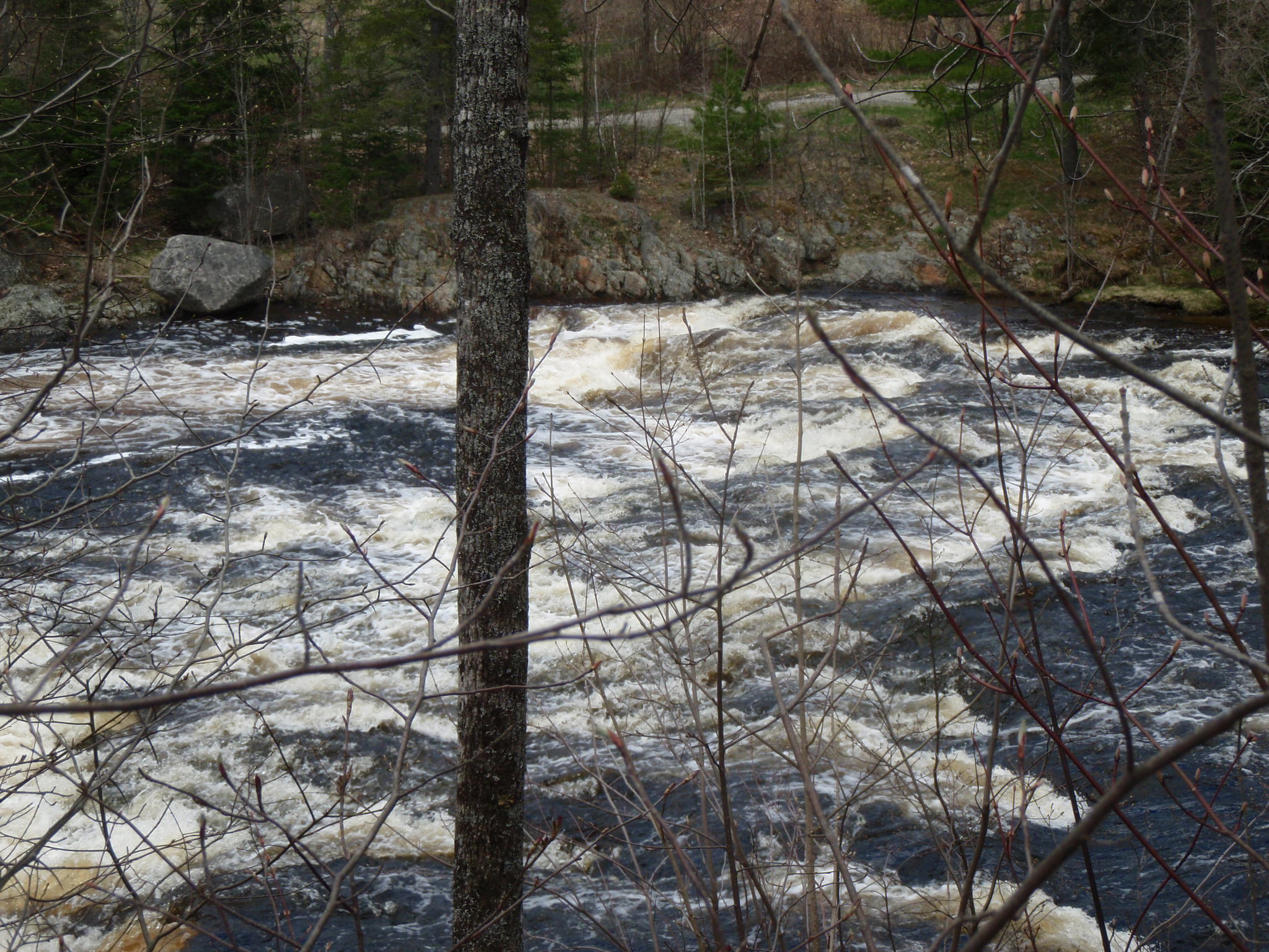
If the Passagassawakeag River is the main artery of Belfast, then the quarter mile stretch between Shepard Road and Route 137 is its secret heart.
Paddlers typically take out above this section, partly due to the dam, partly due to the challenging whitewater that lies below. Those on foot can look downstream from the Shepard Road bridge, from where you will see the first 100 yards. You can also look upstream from Route 137 for about 75 yards. That still leaves a couple hundred yards of secret river, shielded by the sightlines, property lines, trees, and steep terrain — that has been seen by few and traveled by even fewer.
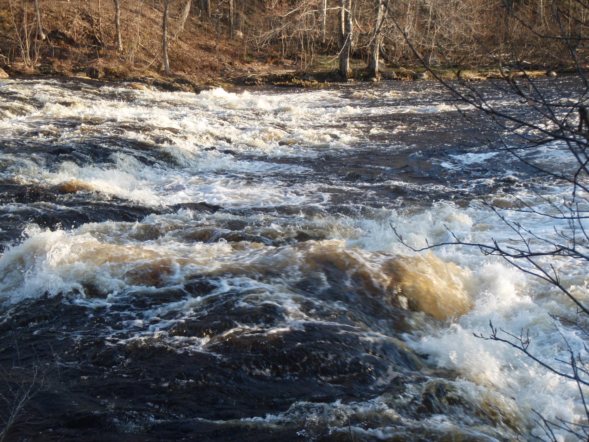
Depending on the time of year and recent rainfall, this section of river appears a boulder-filled stream or a raging, wave-filled torrent. From what I have seen, you’re in for a good ride when water is spilling over the top of the dam. This normally occurs only in the spring or after an especially heavy rain.
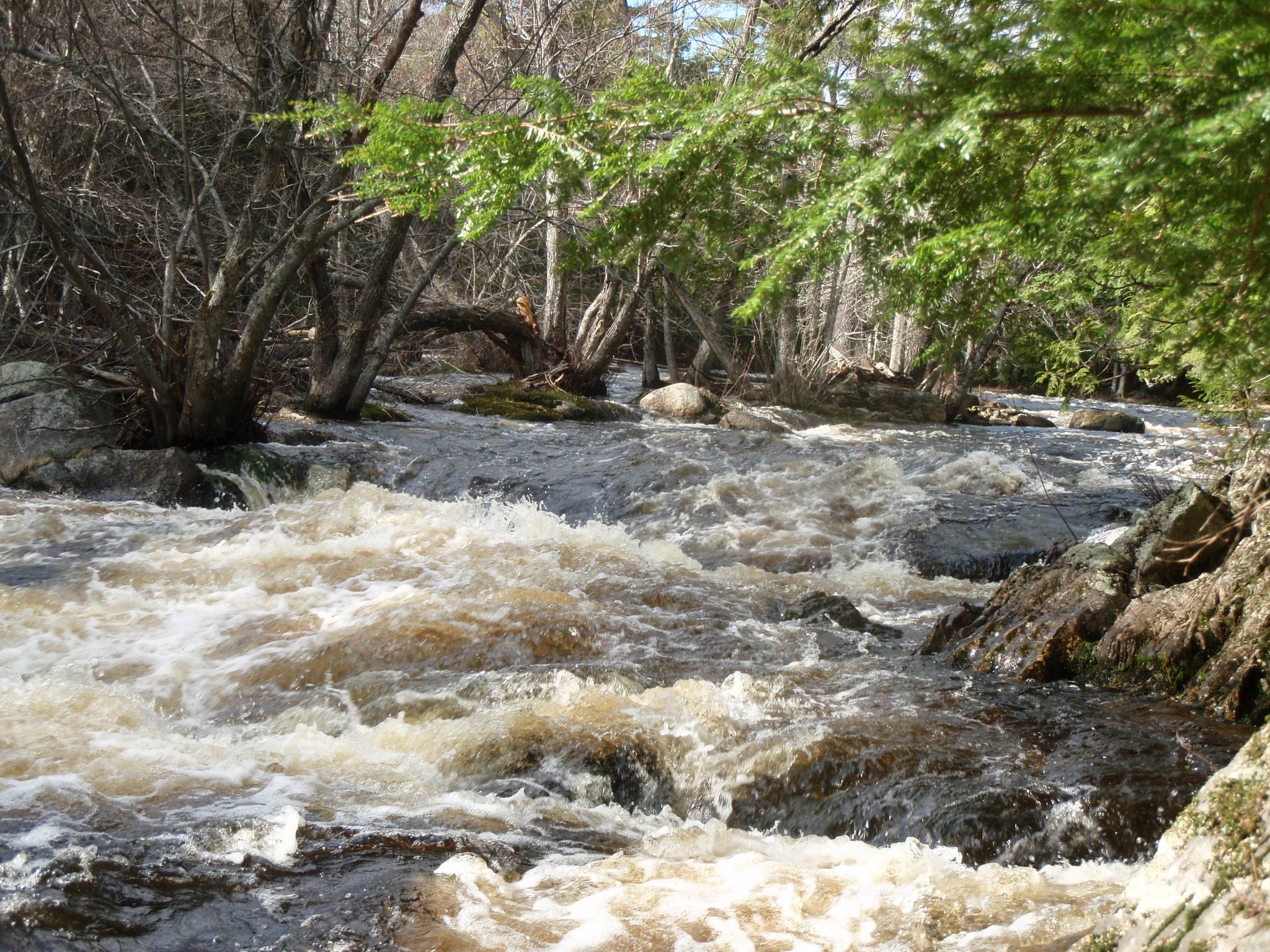
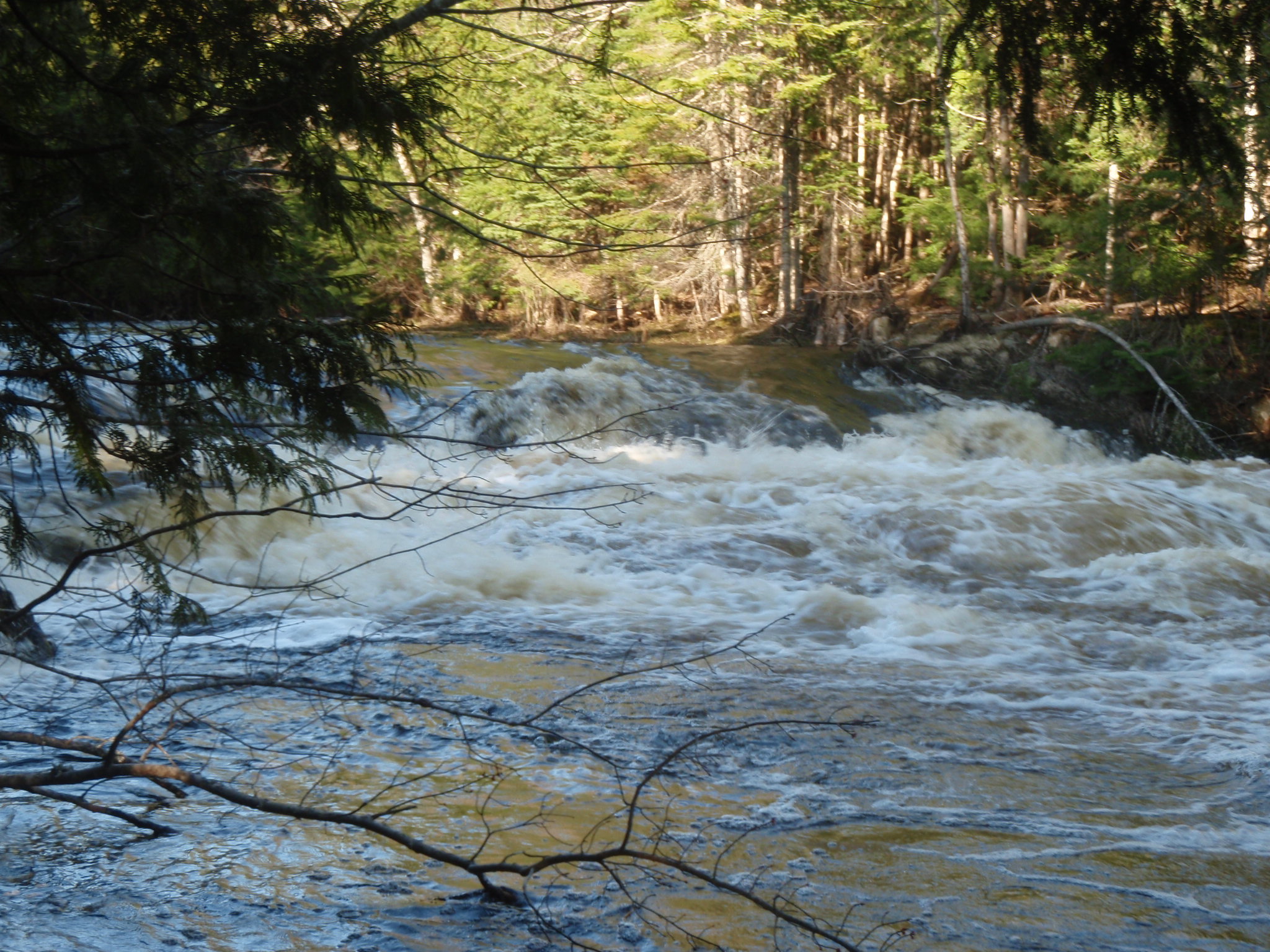
When the river is running high, as it was a week ago, the water from the dam passes underneath the Shepard Road bridge and then races southeast down a rocky channel filled with waves. About a hundred yards in, the river splits around a low island. From there, the river swings to the southwest, narrows and quickens. It then enters a gorge that twists south and then southeast. Somewhere in that turn, with a cliff face defining the right bank, the narrowed, churning river simultaneously twines and plunges over a three foot drop. Below this drop is a frothy tumult of waves big as refrigerators.
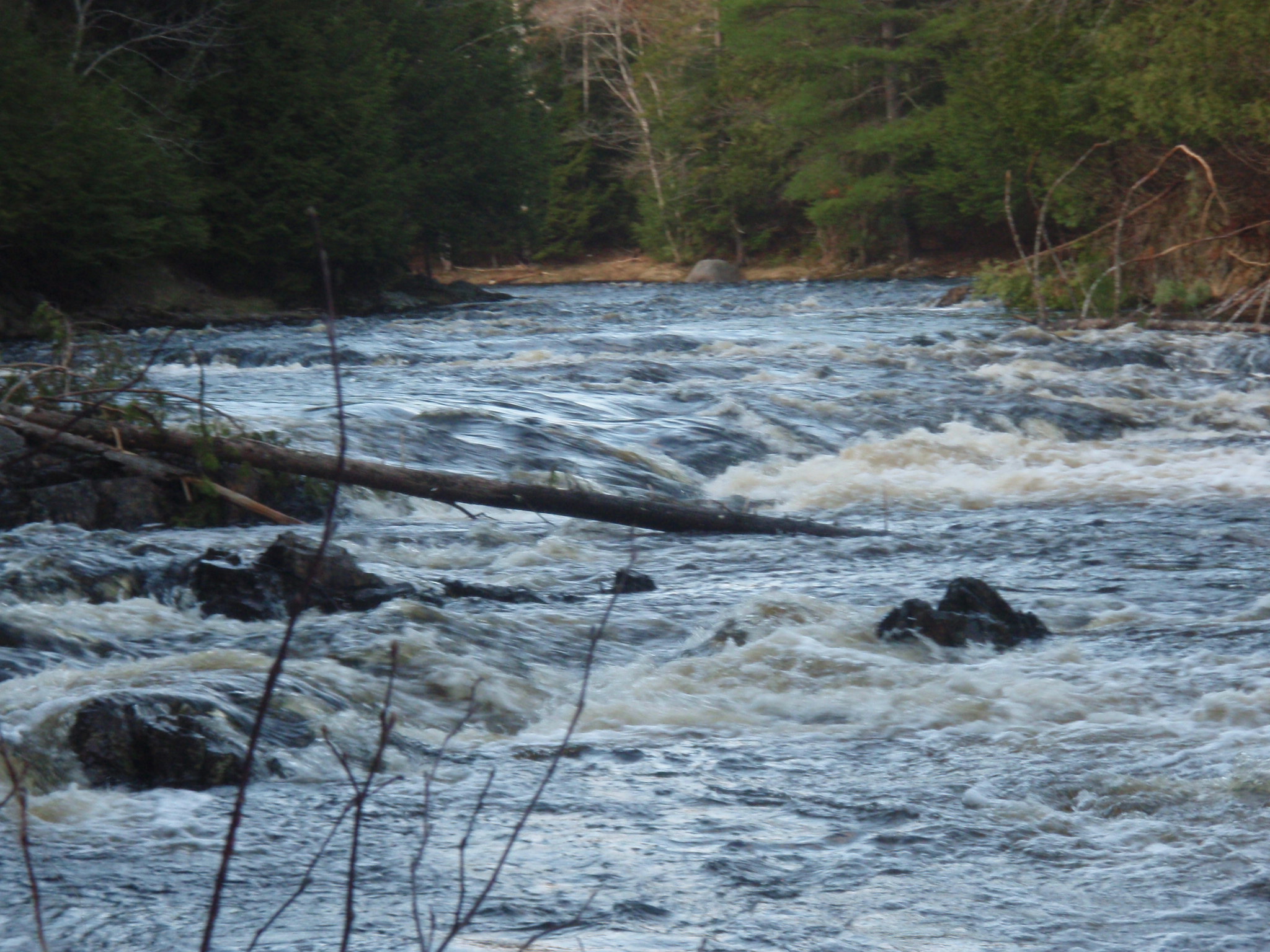
From there, the river rushes onward toward the Route 137 bridge straightening out and tumbling over numerous rocks as it goes.
Fall whitewater is a special treat. When we go weeks or months without paddling a river, we start breaking out maps and looking for rivers that still have water. It’s great when you don’t have to go anywhere — and the rivers come back to you.
*Paddling this section requires Class III whitewater skills. The waves are large and currents are strong. Maneuvering and bracing skills are needed. Additionally, at this time of year, the water is cold. Please do not paddle this section unless you have proper equipment and experience and have proved yourself on the easier sections of local rivers.
Slalom, a race over a winding or zigzag course, isn’t just for skiers anymore. Canoers and kayakers get to slalom too. And they did — last Sunday in the annual slalom races at the Kenduskeag Stream Park in Bangor.
Below the Harlow Street Bridge in Bangor, the Kenduskeag Stream enters a picturesque steep-sided valley. Between the bridge and and the Shopping Cart Drop, the stream is narrow, the currents are strong; and there are two Class II-III drops — drops that have claimed more than a few boats during the 16-mile Kenduskeag Stream Canoe Race. For the downriver racer, the goal is to keep your boat upright, keep your bow downstream, have the right line and cruise right through this area, spending as little time as possible in it, never looking back.
Last weekend’s slalom race brought a whole new perspective to this part of the river, as the slalom required us to go sideways to the current, turn our bows into the biggest waves, reverse direction and go back upstream, take the drops at an angle and eddy out below, and even negotiate some of it going backward.
A good slalom racer, as I was to find, needs endurance to paddle hard for 3 minutes, power to turn a boat and accelerate upriver against the current, and the chutzpah to pull off tricky maneuvers in moving water. More than anything, slalom racing requires boat control and precise paddle strokes. As with many sports, those who are good at it make it look easy.
It’s not easy, however. Even for those with a lot of experience in other genres of paddling. On Saturday, the day before the competition, after getting some tips and little coaching from experienced slalom paddlers, I took my first run at the quarter mile slalom course. The first gate was straight across the river from the starting point and below a drop. Because of the strong current, I wasn’t sure if I could get there without embarrassing myself, so I skipped it, telling myself I’d work on that one on my next run. Gate number 2 looked easy enough, but slightly submerged rocks immediately upstream of the gate blocked my intended line. I missed it. Gate 3 had some really fast current going through it — I made it through cleanly. That gate, however, was offset from Gate 4 which was only eight feet downstream. The current swept me slightly sideways and I battered the pole with my helmet. A 50 second penalty during a race. Gates 5 and 6 were relatively easy and I passed through them cleanly, building up speed as I went. Gate 7, an upstream gate, was far over on river right and above a drop. I approached it too fast, swung far too far past it, and then had to work really hard to get back upstream. Gate 8, another upstream gate, was below the drop. Again, I was moving too fast and settled for just making it through the drop. I skipped it. I was not yet halfway through the course. There were still another eleven more gates to go. You get the idea.
With an afternoon of practice, I was able to at least attempt most of the gates. By race time, the next morning, I was able to get through most of the gates most of the time, but I didn’t always get through cleanly, and it wasn’t always pretty. Meanwhile, more experienced slalom racers in both kayaks and canoes carved their way through the gates with precision and style, never seeming to hurry, never seeming to lose control.
Slalom, then, is a mental challenge as well as a physical one. From what I can see, slalom requires linking the gates and linking strokes. In other words, you need to go through each gate already lined up for the next few gates. If you don’t think about the next gate until after you’ve completed the previous one, it’s too late. The current will carry you downstream and you will miss it. Thinking several moves ahead and initiating moves early is key.
Slalom is a specialized sport with a relatively small following. This is a shame. One of the best parts of slalom is the camaraderie among the participants — some of whom travel throughout New England to participate in the slalom series. The atmosphere among participants is friendly and very welcoming. The difficulty level for these regional races, while challenging, is not overwhelming for intermediate paddlers.
Even if you never get serious about it and join the circuit, slalom is bound to make you a better paddler. Many aspects of river and ocean paddling get easier once you’ve practiced getting through narrow gates. Slalom is also an Olympic sport, one I will take new interest in and pay more attention to, now that I have taken a crack at it myself.
Navigating between the rocks on the Marsh Stream, April 2012.
Some of us have literally spent weeks worrying about low water. No sense worrying any more or complaining about it any longer because it sure looks like that’s what we’re going to get. The hoped for rain simply isn’t going to come in time for the race. The river is not just low; it’s dramatically and historically low. It’s lower than it was on race day two years ago, which itself was the lowest anyone could remember — and it’s lower than that by a lot.
Want numbers? The stream gauge at Six Mile Falls reports a depth of 3.8 feet and a flow of a 144 cubic feet per second. This time of year, the flow generally averages 1,000 cfs. Two years ago, the low year, when the Bangor Daily News headline following the race read “What a Slog,” the gauge read 4.4 feet and 300 cfs.
This year’s Kenduskeag Stream Canoe Race is sure to be unlike any other. And that is one reason to participate. Accept the low water. Embrace it even. The best strategy may be to stop thinking of it as a canoe race and think of it as one of those adventure races that have become all the rage.
Read about Tough Mudder, for example, and a low-water Kenduskeag suddenly seems a little more do-able. There will be more shallows than usual, no doubt — and some of it is likely to be REALLY shallow. More rocks to navigate around. Some of them you might have to haul your boat over. But it still won’t be the Tough Mudder. No one will have to run 12 miles (half of it up a mountain). There will be no fire rings to leap through. No belly-crawling, wall-climbing, ice-water dunking, monkey-bar traversing. or mud-slogging. Well, maybe some mud-slogging.
I’ve stayed up a few nights scouring the web for the secrets of paddling in shallow water. I’ve looked at kayaking, canoeing, rowing, and yachting sites. I even checked out some sites for pilots of large boats. Sorry to say, but there aren’t any secrets. Shallow water is shallow water — and, as is explained below, when you are trying to maintain the speed of your canoe or kayak in these areas, the shallow water literally sucks.
The technical term for this is shallow water drag. As one site states, referring to the work of David Burch, when your boat enters water that is 12 inches deep while paddling at a speed of 3 knots, the resistance increases 90%. That’s nine zero, ninety. Basically it doubles. Another source, also referring to Burch, states that hull speed is reduced by 50% when paddling a kayak or canoe in water that is 2 feet deep.
The loss of speed is due, at least in part, to the increased resistance of the bow wave. In shallow areas, the water can’t move away from the boat as easily and therefore piles up at the bow. For the paddler, this creates the unwelcome sensation that you are paddling uphill.
As if things aren’t bad enough already, shallows can cause your boat to actually sink lower in the water, thus creating even more drag. This is due to the Venturi effect, (told you I had been up late reading) which holds that differences in the speed that water moves creates differences in pressure. In shallow water, the water that passes under your hull has fewer places to go and thus must move at a higher speed, which in turn creates an area of relatively lower pressure, which results in your boat sinking deeper. The faster you go, the more your stern will sink or squat down into the water. Isn’t that just great!
Still another factor, one that you can actually do something about, is called bank suction. I’m not making this up. According to the article at Don Fleming Yacht Services, “Bank suction starts when a vessel strays too close to a bank, restricting the water flow on its bank side. The water-flow velocity increases, causing the water between the vessel and the bank to squeeze out of the area faster than it can flow back in. This causes the water level to drop between the vessel and the bank, and consequently the vessel is pulled sideways into the low-water area.” Unfortunately, it doesn’t just affect large vessels. Watch for this, especially when rounding a bend in shallows. I’ve felt the stern of my kayak being pulled toward the bank just as is described above.
A few suggestions for this year’s Kenduskeag Stream Canoe Race:
(1) Seek deeper water, even if you have to paddle out of your way to find it.
(2) Back off your pace a bit as you approach a portage or a shallow area that you plan to haul over. The time you will lose by doing this is generally less than what you would lose by arriving already out of breath at the portage.
(3) Don’t expend too much energy in shallow areas. The laws of physics will prevent your boat from gaining much speed there, no matter how hard you paddle.
(4) When approaching shallow areas that are followed by deep water, you may want to try increasing your speed enough to “pop” your hull ahead of your own bow wave. Experienced racers talk about this, but I’ve never yet seen it done.
(5) Attach a rope to your bow that can be used to pull your boat through areas that are too shallow to paddle through.
(6) Don’t try to pass another boat by going through the shallows on the the outside of a turn. See the description of bank suck above.– only imagine it being amplified by the effect of the other boat.
(7) Flip flops won’t make it. Wear something sturdy on your feet and consider something that will protect your legs as well. Shin guards (no joke) would probably work pretty well for reducing the rock-inflicted bruising you might get when walking or running through shallows.
(8) Leave your watch at home. No records will be set this year. Not the kind you want to set, anyway.
If you can’t paddle, run. If you can’t run, walk. Don’t stop until you get to the tent with the food in it. That appears to be a winning strategy for this year’s race. The 2012 Kenduskeag Stream Canoe Race: it will be an adventure.
Story has it that the Union River takes its name from the fact that when the area was surveyed by Samuel Livermore in the late 1700’s, the river ran right down the middle of twelve newly formed towns.
Nowadays, the upper part of the Union is in the middle of nowhere — and that is just fine with us.
The West Branch of the Union, north of the Airline Road, is billed as Hancock County’s “finest” whitewater run. We ran it last Saturday for the first time, and it didn’t disappoint.
After a 50 mile drive from Belfast to Amherst via Bucksport and Dedham, we pulled over alongside Tannery Falls (just off the Tannery Loop) and unloaded our bicycles, which we would use later for our return to the put in. We took a close look at the falls, which though rated “only” a Class III looked fairly gnarly. Would we run the falls or take out above them? We reserved that decision for later. According to the Zip Kellogg’s canoeing guide, if exposed dry rock is visible at Tannery Falls, the river is too low to run. If the falls have the appearance of a raging river, it advises, “Don’t try to paddle the river.” The level looked closer to raging than to dry, but “raging” — we decided — is somewhat a matter of perspective.
We drove 12 miles north to Great Pond via Aurora and the Great Pond Road. After passing through the tiny village of Great Pond, the road turns steeply downhill to the Great Pond Recreation area (formerly Dow Pines), a military-owned campground (open year year; includes cabins and yurts as well as tent sites) that allows public use of their beach and boat launch. The 375-acre recreation area borders the entire southern edge of Great Pond and also extends south along the western shore of the Union River.
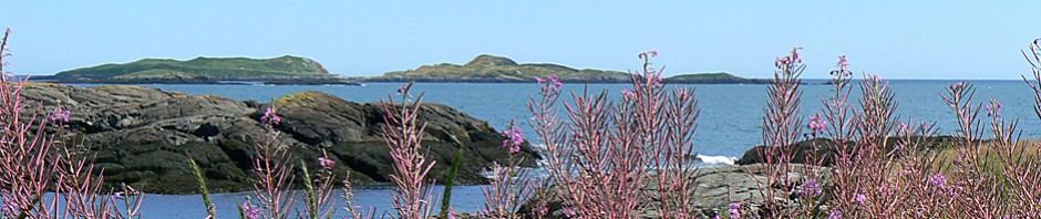
We launched our kayaks from the sandy beach and headed south through a bay that gradually narrows to the mouth of the river. Great Pond is largely wild and undeveloped. Kellogg comments that it is particularly beautiful in the fall, as the the pond is in the center of a bowl of hills and the surrounding slopes have plenty of hardwoods.
Although some sections of the river are not far from roads, The West Branch of the Union provides a sense of wilderness and seclusion. We sighted no other paddlers, and only a few fishermen during our 11 mile river journey. The area is rife with wildlife, however. Hundreds of ducks as well as hawks, deer, turtles, blue heron, cormorants, beaver, and wild turkeys were among the wildlife we encountered.
Tannery Falls.
Tannery Falls: view from the western shore.
Hell Gate
4th Falls
Captains Roll
Tannery Falls.
Tannery Falls.
Union River, West Branch
The paddling was outstanding. The river is larger and has stronger currents than most of our midcoast rivers. That plus the seclusion and our unfamiliarity with the river made us a bit conservative. The river has sections of flatwater, frequent stretches of rips and easy rapids, and a few stretches of challenging whitewater (strong currents and decent sized waves). Most notable are the drops. The West Branch has multiple small pitches of a few feet in height. It also has four larger ones, with names like “Hell Gate” and “Captains Roll.” Kellogg recommends scouting these drops and we emphatically concur.
The importance of scouting was reinforced by our experience at one of the earlier, easier drops. Without scouting it beforehand, we lined up to take the drop at Bog Dam rapids “right of center,” just as the guidebook suggested. However, immediately after taking the drop, I was spun and nearly capsized by a mossy green sleeper rock. Leslie, who had been following close behind, backpaddled to avoid my boat, never saw the rock, had her kayak pushed far up onto it, and was spun before finally capsizing. (See all the action in the video below).
Partly due to the time factor (it often takes longer to scout and then go back upriver and run a rapid than to simply portage it), we opted for short portages around the three major drops and took out above the fourth. This was a recon mission — and for that day at least, just being in the vicinity of those falls provided plenty of adrenalin.
Those pitches are not easy to get out of your head. I’ve been seeing Hell Gate in my dreams and am itching to head back up there and give it a try.
A week ago, the fact that the St. George River Race was just three weeks off seemed incongruous. Snow was waist deep along the driveway, woodpile and picnic table were still hidden. Small hills and gullies were beneath a uniform blanket of white. It seemed likely paddlers would have a tough time finding the St. George River, never mind paddling it.
With the rains of last week, everything changed. The new concern is that the melt will come too fast rather than too slow. The seasonal landmark that the St. George River will be open by the last Saturday in March now seems like a good bet.
For those who haven’t paddled these rivers before, entering one of the local river races can be intimidating. But anyone thinking about it should keep in mind that there are always novices among the field and that for many racers it is more a rite of spring, a social experience, or a chance for a good workout rather than a serious competitive endeavor. Additionally, these races (and the clinics beforehand) actually provide an ideal opportunity for less experienced paddlers to learn a river. Unlike other days, on race day, there are rescue personnel at the danger spots, plenty of other paddlers around to learn the river from, and plenty of opportunities to hitch a ride back to the start.
More than 3 dozen paddling races will be held before the leaves turn in October. The first four races leading up to the Kenduskeag are:
1. St. George River Race: 11:00 AM, Saturday, March 26. 6 miles. For paddlers: The St. George is mostly Class I and II and is a great race to begin with. Apaddling clinic is offered the afternoon before the race. See the race: Spectators and river vultures typically gather at the start on Route 131 near downtown Searsmont, on the Ghent Road Bridge, and at the finish on the Route 135 bridge. River fact: At high water levels, this river can be easier to paddle as the drop at Magog is smoothed out and there are fewer rocks to avoid. Contact: Waldo County YMCA.
2. Passagasswakeag River Race. 11:00 AM, Saturday, April 2. 6 miles. For paddlers: The Passy is just a wee step up from the St. George in terms of difficulty. As with the George, apaddling clinic is offered the afternoon before the race. See the race: The Rollerson Bridge on the Poor’s Mills Road is the most popular spot from which to watch this race. River fact: When the water is high, the river offers a short cuts where savvy paddlers can leave the main course of the river and cut through the woods. Contact: Waldo County YMCA
3. Soudabscook Stream Sprint & Race. Saturday, April 9. 9:00 AM and 12:00 Noon, Saturday, April 2. 2 and 8 miles. For paddlers: Stronger currents and several Class II and III drops make the Soudabscook is a step up from the two earlier races. Scouting the river beforehand is essential. Several portages are involved. See the race: Several places off the Emerson Mill Road and the Papermill Road in Hampden. River fact: Soudabscook means “sloping ledge.” As with many rivers, this river was named for a predominant feature at the river mouth — in this case, where it joins the Penobscot. Contact: Additional information is at www.mackro.org
4. Marsh Stream Race. Sunday, April 10. 9:00 AM and 12:00 Noon, 1 and 8 miles. For paddlers: Like the Sou, the Marsh Stream offers challenging Class II and III ledge drops and the currents can be strong. Scouting the drops beforehand is essential. Several portages are involved. The race course is sometimes shortened in years of high water. See the race: Several locations along the Stream Road in Winterport are ideal for watching paddlers negotiate drops. River fact: The Marsh Stream race course includes a portage around Flatrock Falls, which is considered Class V. Contact: Additional information is at www.mackro.org
Three men dip their paddles into the calm waters of the remote lake and move their canoe up a relatively small inlet. The year is 1903. The lake is Grand Lake, a gateway into the unmapped and untraveled wilderness of Labrador. Their plan is to canoe and portage their way 600 miles west and north to Northwest Post on the Hudson Bay, a heretofore unattempted journey. They do not realize it, of course, but a mere 2 days and 40 miles into their trip, they are making the journey’s most pivotal decision — one that will lead beyond failure to disaster — and for one of them, death by starvation.
Great Heart: History of a Labrador Adventure by Davidson and Rugge is an account of this journey, as well as of two subsequent journeys through the wild interior of Labrador by canoe.
One thing that strikes me is their decision to head upriver from the inlet without more fully exploring the northern end of the lake, which in fact has three other major inlets. One of these is the Naskapi, the river they had intended to take. But it was approaching mid-July in the short Labrador summer, and their journey had already been delayed by several weeks. The river they had chosen seemed to fit their map and the vague descriptions from local trappers well enough. In the next few days, as they paddled farther, the river became unexpectedly shallow, steep, and rocky, forcing frequent portages.
Had circumstances been different, they might have re-thought their route. Instead, they continued on for 60 days and 150 miles through an impossible landscape of steep hills, wide swamps, and thick forests. In mid-September, after almost uncountable miles of portaging their heavy gear, they spent several days windbound on a lakeshore and finally turned back. By this time, their food supplies were exhausted, the rough country had torn their clothing to shreds, and they were dangerously thin from physical exertion and a lean diet. Temperatures were dropping; game and fish were more scarce. Their retreat became a race against winter and starvation. Two of the men managed to make their way back to the starting point. The third, Leonidas Hubbard, the leader of the expedition, died of a combination of starvation and (likely) hypothermia.
The title of this post intends no disrespect toward members of the Hubbard Expedition. The mistake they made could have been made by any of us. The information they had told of a river leading out of the northern end of Grand Lake. The first river they came to was that river — this was the conclusion they leapt to. The maps of the time were made up largely of blank spaces when it came to interior Labrador. When the map did not conform to the territory they saw in front of them, they mentally willed the territory to conform to the map.
Their story has lessons for all of us who venture into the unknown, whether it be taking a back road to cut across town, guessing left at a fork in a hiking trail, or guessing right at a confluence of two rivers. Their refusal to turn back, despite mounting evidence that they had taken a “wrong turn” followed stages many of us are familiar with.
First, there is absolute belief that we have chosen the correct route. During this stage, any signs to the contrary are ignored. If the map has led us to expect a river and we find a stream, we stretch our mental construct such that it becomes a “small river” and continue. In the second stage, our denial deepens. We begin to have doubts, but we keep on, telling ourselves if we go just a little farther, the landmarks we were anticipating will appear, and the visible landscape will begin to conform more closely with our expectations. Stage 3 involves accepting that we probably have taken a wrong turn. Not wanting to retreat, we bargain. Just go a little farther, we coach ourselves, and we will have more complete proof that we are in the wrong. Stage 4 involves certainty. We know we are wrong. But we have come so far already that turning back has a significant cost. Better to keep going and hope for a stroke of luck. Maybe we will yet come out of this better than we have a right to hope.
Most of us have been there. Most of us will be there again. In this era of Google Earth, it is more tempting than ever to think that map and territory are one in the same. The map is not a physical thing though; it is a mental construct. It is what we can hold in our heads. The territory is something altogether different. And that is why we go there. We go to have our preconceptions shattered. We go to have better maps.
Great Heart is a story about human stubbornness; it is also a tale of ambition and courage. Most of us who seek adventure in the outdoors will be able to see ourselves making the same decisions made by these men, and that is part of what makes this journey so gripping.