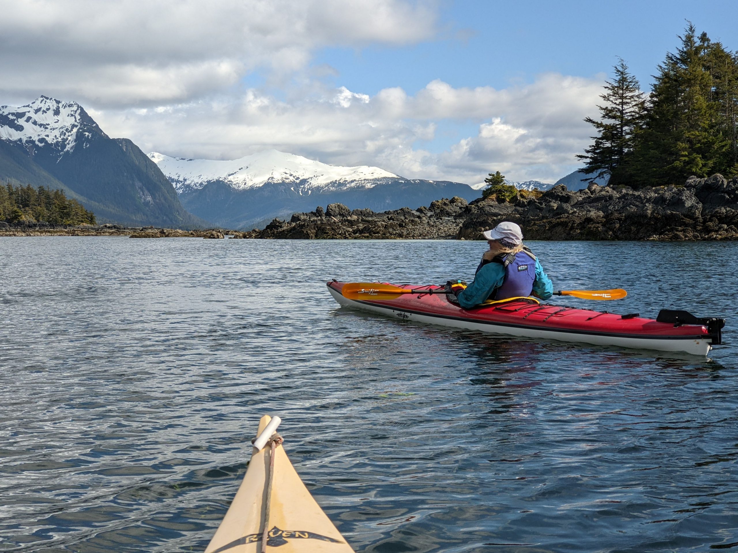
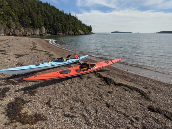
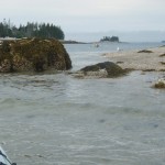
A photo from our recent paddling adventures in Sitka, Alaska.
Our tour offerings are greatly expanded this summer — in hopes you’ll tour more with us. In addition, our website has been re-organized so that it is now either to search for kayak tours by date or by geographical area.
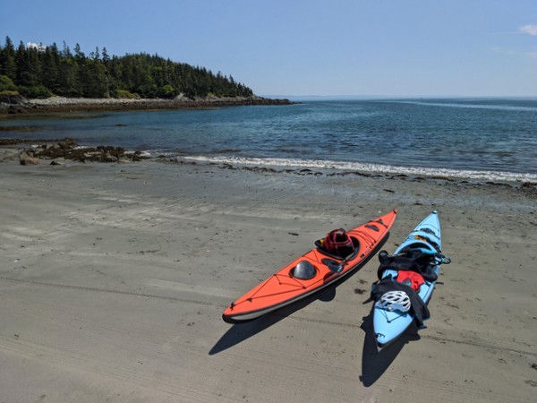
You can now search for our sea kayak tours in the areas of Rockland (including Muscle Ridge), Belfast, Stonington, Schoodic (including Acadia National Park / Mount Desert Island), and Jonesport.
If the dates of our scheduled tours don’t work for you, please contact us as we still have many open dates and are eager to provide custom tours.
Our July coastal Maine sea kayaking trips have featured Frenchmen’s Bay south of Sorrento, the archipelago of islands south of Cape Split (South Addison), and the Bold Coast near Lubec / Quoddy Head State Park.
Despite a winter that brought 100 inches of snow, the 2015 spring whitewater season in midcoast Maine was all too brief. Our annual transition to the bays and islands thus came a little sooner than usual. Based on demand, our summer featured day tours out of Belfast, Rockport, and Camden harbors as well as Stonington. in 2015, for the first time, we offered stand up paddle board rentals and instruction. Our own paddling included racing in the Whitewater Nationals in Old Town/Bangor and sea kayaking forays further Downeast to Cutler, Lubec, and Campobello. Early dawn paddles seeking out whales in the fog has become one of our passions. We plan to offer tours out of Lubec and Campobello in summer 2016. Thanks to all those who joined our tours in 2015. We hope to see you all again next summer!
The hottest summer on record has meant an increase in the number of guests from states like Texas, Oklahoma, and Virginia.
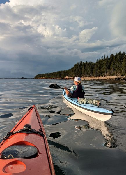
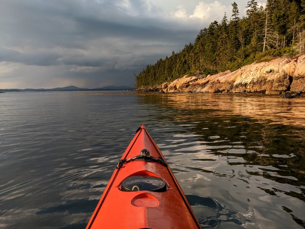
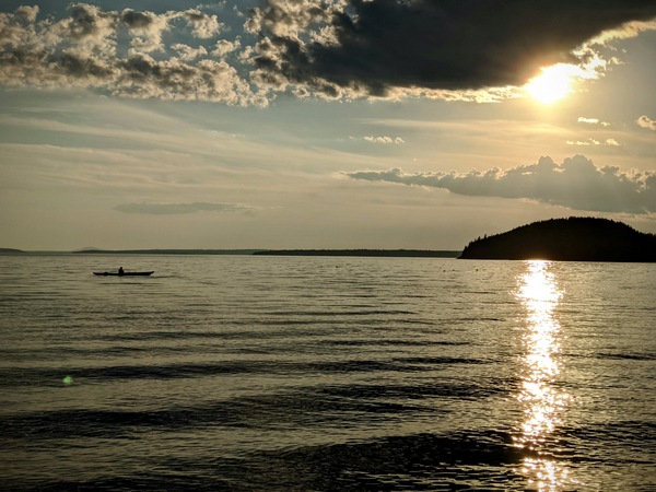
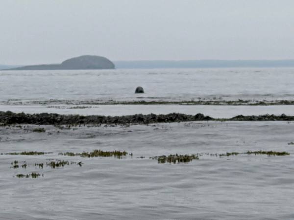
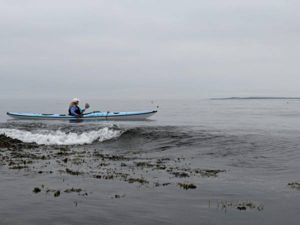
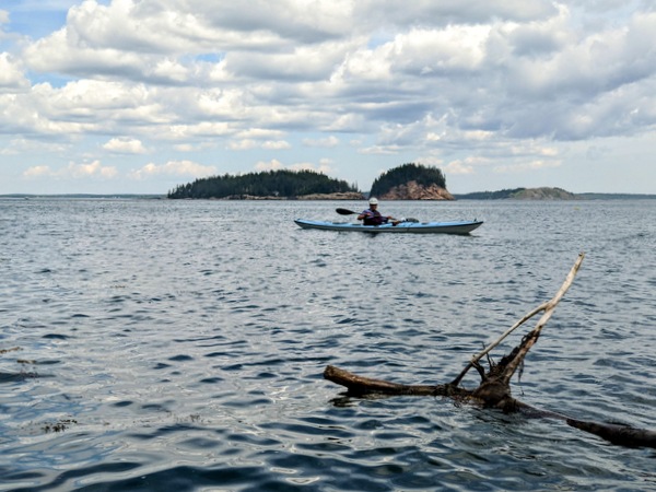
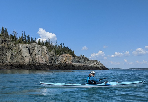
It also has meant a lot of great weather for kayaking. While summer is not officially over yet, the approach of Labor Day and the start of the school year means it’s time for our annual slideshow — a celebration of some of the summer’s best moments — so far.
There’s still time to get out and enjoy the lakes, rivers, bays, and islands. We hope you soon have the chance to do just that.
(To view the slideshow is larger format, click the slideshow and then click the text link “Full Screen” in the upper left hand corner of your screen.)
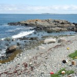
If you drive 26 miles east from Ellsworth to Steuben, and then 6 miles south from Route 1 on the Pigeon Hill Road, you reach near the end of a peninsula that protrudes as far south as the town of Bar Harbor and Schoodic Point. The Petit Manan Refuge is one of the five refuges that together make up the Maine Coastal Islands National Wildlife Refuge.
Petit Manan Point is named after nearby Petit Manan Island, which itself was named by Samuel de Champlain and means “island out to sea.”
The refuge consists of 2,195 acres, both on Petit Manan Point and on nearby islands.
Like the other four refuges in Maine, Petit Manan provides a seasonal home for endangered neotropical songbirds such as the American redstart, Sawinson’s thrush, and song sparrow. The saltmarshes and mudflats provide habitat for black ducks great blue herons, American bitterns, sandpipers, and more. According to the refuge brochure, “During fall migration the 80-acred Cranberry Flowage on Petit Manan is filled with over 4,000 . . . black ducks, green-winged teal, and mallards” who use it as a resting and feeding spot.
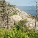
We often say that kayaking is the best way to see the coast, but walking is also good — and it sometimes gets you places unreachable by other means. Petit Manan Point presents a strong case for the argument that being able to see the water is not always a prerequisite of coast. For even where the trails take you over glacially scoured terrain and down into the deep shade of white cedar forests, the fingerprints of the ocean are unmistakable and everywhere. In the cool, moist salt air. In the peat bogs, the subarctic vegetation, and the tamarack. In the thrushes, sparrows, and warblers. In the wildflowers, and –yes — in the sound of distant surf.
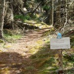
Petit Manan Point offers two main options for hikes. The shorter, easterly hike (Hollingsworth Trail) seems to be favorite of some. The longer, westerly hike — (Birch Point Trail) has recently undergone upgrades that include new plank bridges in the boggy areas.
For our late day, late May hike, we chose the Hollingsworth trail, which, as we found, provides a tremendous variety of vegetation and landscapes in a 1.5 mile loop. There is also opportunity to extend the hike by walking south along the beaches toward the southern tip of the peninsula.
Whether you go in May or August or October, there is likely to be lots to see — and a good chance to see something you haven’t seen before.
This time of year I trade my downriver kayak for a sea kayak. Rather than a wing paddle, a flat-bladed Euro paddle occupies a place in the backseat of my car. Instead of monitoring stream flow data, I keep an eye on the tide charts. The bays and islands, not the rivers, become the target of my afternoon and weekend plans.
River paddling is linear. We drive upriver and then make the trip down, sometimes repeating the trip on the same day. The days are still short. Daylight is at a premium. We look at our watches and paddle harder to make sure we can get to the take-out by sundown. The river itself is a line, albeit a living and moving one. In sections where rocks interrupt the river’s smooth surface, we seek to run the ideal lines, following the current, avoiding the rocks and holes. As spring advances, we move from the first rivers to ice out to the ones that hold their level longer, due to upstream dams or large watersheds. This migration, too, is a line, a sequenced progression repeated from one year to the next.
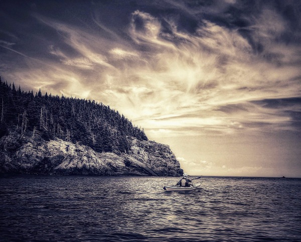
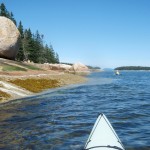
Ocean paddling is more about arcs and circles. The days are longer and warmer and we shed the sense of urgency that kept us in continuous movement. We linger in quiet coves or pause for a moment to bob in the waves. The number of put-ins and take-outs is almost infinite — as are the routes between them. Getting from point A to point B is about possibilities. The tide rises and falls. The winds swing from north to south and back again. We skirt shorelines and trace the gentle arcs of pocket beaches. We circumnavigate islands for the sake of doing so. Destination becomes less important. There is no end to get to. Just a vast sea to experience and appreciate.
It’s a very human thing to resist change and to mourn it. The time to ride the rivers on the flood of snowmelt and spring runoff is always abbreviated. The brief season of running rivers is one of thrill and urgency and a little bit of danger. And then the rains slow and the rivers subside, and we make the transition back to the sea. We go reluctantly at first, but then, after arriving, we are glad to feel waves rise underneath us, glad for the early light and the islands, glad for the seal pups and eider chicks, glad for the island blueberries and wild roses, whose own time is even now growing closer.
As the waters cool, the days shorten, and my schedule transitions from guiding to teaching, my relationship with the water changes too. I look longingly over the bay as I cross the bridge to East Belfast on my morning commute. I hurriedly squeeze in an afternoon paddle between a meeting at school and picking up the kids. Paddling trips are shorter and closer to home. The place where I put in is more likely Belfast Harbor or Pitcher Pond rather than South Thomaston or Stonington. The equinox is a great time to reflect on the summer that was. Days like today give hope that there is a little more of it still left.
Summer started cool, with temperatures on June 24 topping out at 57 degrees. July made us believe in global warming all over again, with 12 days of temps above 80 degrees, and 25 days of at least partial sun. August was more of a mixed bag, but there were still a good number of sunny days and an influx of tourists. Suddenly everyone wanted to get out on the water — today!
Irene brought wind, waves, and rain — and hastened many to pull their boats out of the water. The nice thing about kayaks is that they’re easy to put back in.
Three kayakers lost their lives in Maine waters this summer. One was wearing a life jacket. Two were not. Thousands and thousands of others paddled Maine’s lakes, ponds, and rivers without mishap. Still, an emergency bill is being introduced in the Maine legislature that would make wearing (and not just having) a life jacket a requirement for all those kayaking and canoeing in Maine waters.
I’d rather see an effort to get more paddlers to wear their life jackets through education, not legislation. Do wear your life jacket and be mindful that waters are not as warm as they were a month ago. Paddle safe and enjoy!
Our end-of-summer slideshow has become, for us, a seasonal rite. We hope you enjoy it. A big thank you to all who joined us on our tours. And to those who didn’t, just remember, we can’t put your photo in the slideshow unless you come paddle with us.
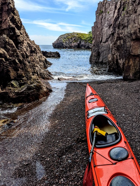
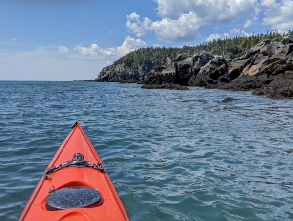
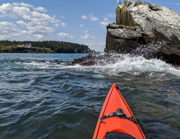
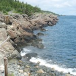
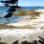
The southern tip of Isle au Haut, between the rocky islets of Eastern and Western Ear, is an otherworldly place of rock, ocean, and sky. Along with the southern shores of Monhegan, Matinicus, Schoodic, and Great Wass, it is among the most exposed places on the Maine coast. Kayaking this remote stretch of coastline is not for the untrained or faint-hearted.
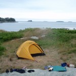
Sea conditions last Saturday (July 30) were settled enough for us to give it a try, and try we did. On the day before, we had paddled out of Stonington under grey and somewhat ominous-looking skies. We dodged south around Scott, Green, and St. Helena Islands, seeking protection from the stiff headwind when we could find it. Steve’s Island, a favorite, was occupied by a group of kayakers, so we pushed another mile across Merchant Row to Harbor Island, a BPL Island that is also part of the Maine Island Trail, where we set up camp for the night. After a night full of rain and wind, we set off the next morning for a 20-mile circumnavigation of Isle au Haut.
As we paddled south between Burnt Island and Isle au Haut, the fog thinned, the wind eased, and our spirits lifted. The forecasted day of blue skies and light and variable winds seemed to be materializing after all. The winds from the night before were still present in the form of a storm swell that rhythmically rolled in on us from the east.
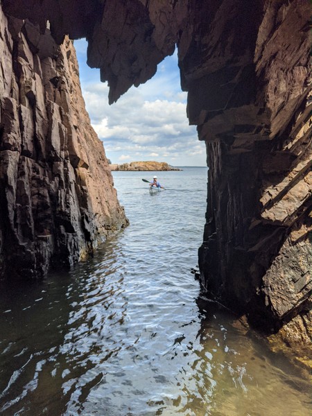
The eastern coastline of Isle au Haut is cliff-lined, rocky, and varied. Well-maintained homes and estates are interspersed along its shores. A procession of ledges and islands line the horizon to the east. These ledges and islands provided welcome protection from the storm swell. As we neared the high cliffs of Eastern Head, swells were converging from two directions — from the southeast and the southwest — making for confused sea conditions and difficult paddling.
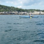
“Sure Thing!” Setting off from Stonington Harbor
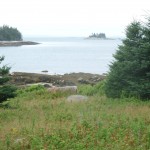
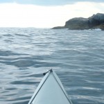
View to the northwest from Harbor Island
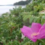
Wild roses on Harbor Island
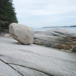
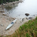
Gravel beach at Harbor Island
Mt. Champlain on Isle au Haut rises in the distance.
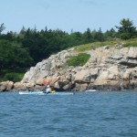
Paddling along the cliffs of Eastern Isle au Haut.
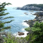
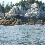
Isle au Haut, eastern shoreline
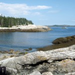
Isle au Haut, southern coastline
Cove on the southern coast of Isle au Haut
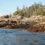
Rocky shoreline along the western shore of Isle au Haut.
Rounding the basalt cliffs of Western Ear.
Cliffs of Western Head, Isle au Haut
From along the trail southwest toward Western Head
Cliffs of Western Ear, Isle au Haut
Coastline of western Isle au Haut
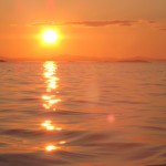
Sunset near Hardwood Island
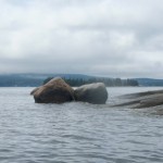
near McGlathery Island
The southern coast of Isle au Haut
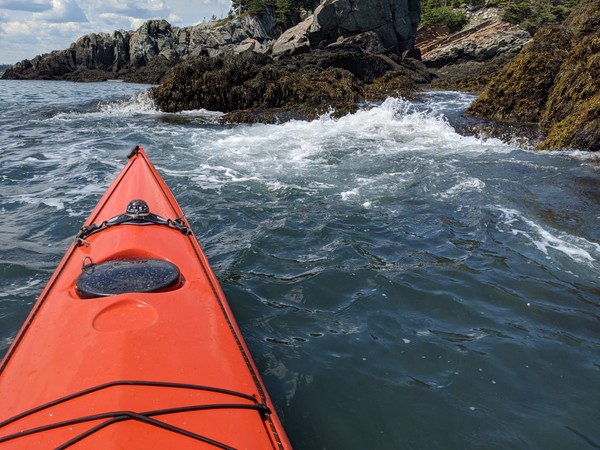
We shot the passage between Eastern Head and Eastern Ear. Swells whose crests rose above our heads raced toward us. Powered by adrenaline, we dug our paddles in and pushed up over the wave crests. With0ut a doubt, rounding the southern part of Eastern Ear was the most challenging part of the trip.
The seas there were steep-sided, confused, and — counting the refracting waves off the cliffs — now coming from three directions at once. Occasional guillemots marked the water. Occasional lobster boats marked the horizon. Other than that, it was just the two of us, the distant cliffs, and the big sea. Out there, in that wild and foreign environment, the smell of the sea sharp in your nose, the sunlight bright in your eyes, and the swells lifting under you, the very planet seems to palpitate, to hum, and to roar. Your senses are so wide awake, it is as if you can hear the earth’s heartbeat — and your own heartbeat too.
The southern coast of Isle au Haut
We stayed far offshore to minimize the effects of the refracting waves and paddled steadily across Head Harbor, looking for a beach where we might land or a shoreline where we might get some relief from the waves. By this time, the seas seemed less dangerous, but paddling still required our full attention. A moment of inattention and a capsize in these cold waters was not something we wanted to deal with.
At last, we made our way west-northwest into a somewhat protected cove and landed on a rough cobbled beach.
After lunch and a short hike along the shoreline cliffs, we launched our kayaks and paddled around Western Head. By then, the winds had calmed and the storm swell had diminished. The waves out of the southwest were still large enough to keep us from getting too close to the cliffs. The tide was too low to allow us to shoot the passage between Western Head and Western Ear, so we rounded the ear and turned north into progressively calmer conditions.
The afternoon light dramatically highlighted the cliffs of the wild shoreline north of Western Ear. We paddled on happily, feeling assured that the most difficult conditions of the day were behind us. The sky was blue; the sun was friendly and warm. We loitered among the ledges, watching seabirds, taking photos, and gazing at the cliffs.
We paddled into Duck Harbor to replenish our water bottles and quickly check out the campground, which I had not visited in several years.
As we moved north from Duck Harbor, we felt both a sense of haste (the day was waning) and leisure (the light was beautiful, the water was calm and increasingly glassy).
We crossed past the western edge of Kimball Island, paddled east along Kimball Head, and then swung north toward the southern shoreline of Merchant Island. The subtle “huff” of a harbor porpoise is something I heard several times without being able to confirm it. And then we started to see them, repeatedly breaching the quiet water as they worked the ledges for fish. We spent a entranced half an hour moving among the breaching porpoises while they moved around us.
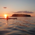
By now the sun was nearing the horizon. It was time to make a push for our campsite on Harbor Island. We rounded the western shore of Merchant, paused to watch the sunset, and then returned, tired, hungry, and happy to our campsite.