Categories
Belfast kayaking Maine rivers

Source to the Sea — A Goose River Journey

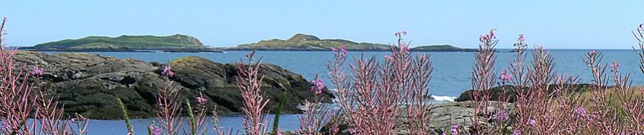
Many people have put in at the boat landing on Swan Lake Avenue and paddled Upper Mason Pond.  Some  have followed the winding course of Goose River south from Swan Lake.  Others have kayaked to the dam on Goose River at the place where it spills into Belfast Harbor, looked upstream, and wondered.  We had done all these things. Many times.  A curiosity about connecting the dots, an ethic of “paddle lots, drive little,” and a penchant  to spend the good part of the day on the water were all part of our decision-making.  A November day of sunshine and temperatures in the fifties sealed the deal.

Could we paddle Goose River from Swan Lake to the sea?  The question was there.  The idea of a backyard-style expedition was born.

It was a somewhat outlandish proposition.  After eight miles of mind-numbing meandering, we would face five dams in the space of the last two miles, and a portage around each. We had never heard of anyone running the lower section and had never scouted it from its banks.  Why would anyone attempt to run  it, we conjectured, unless it was part of a bigger trip. The idea seemed just crazy enough to give it a try.

After planting a car at the far end, within sight of the ocean, we put in just below the dam at the south end of Swan Lake and paddled 50 yards north through the culvert to get as close as we could to the lake.  Then we turned south toward the sun and the sea and headed south.

Ahead of us, though we didn’t fully appreciate it yet, were ten or more miles of river.  Roads cross or touch the river only a half dozen times in those ten miles.  For the vast majority of the distance, Goose River is hidden away in a private valley, visible only to those moving along it.  Along the way, we would sight muskrat, eagle, ducks, and heron.  And for the first eight miles, at least, not any people.


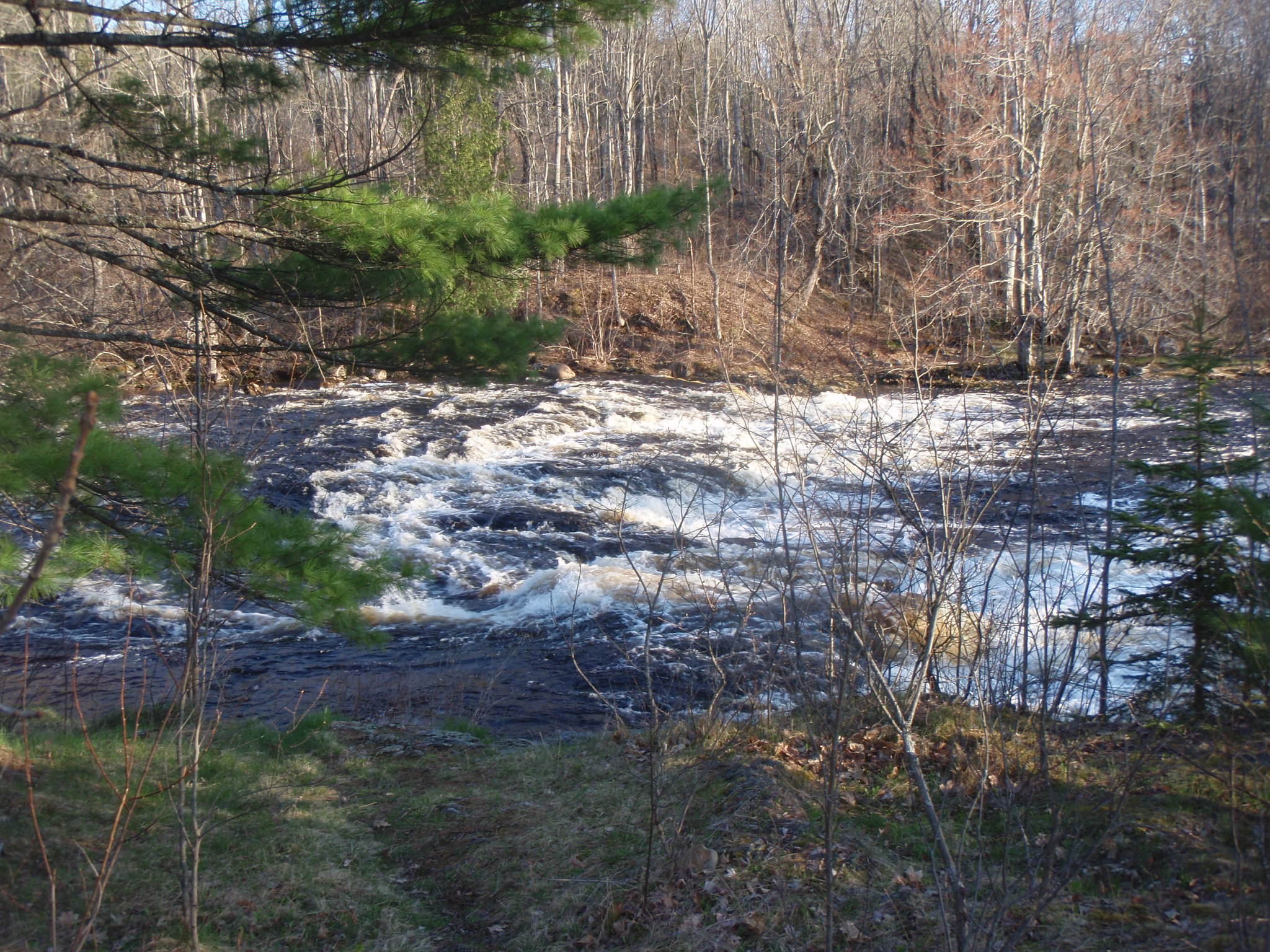
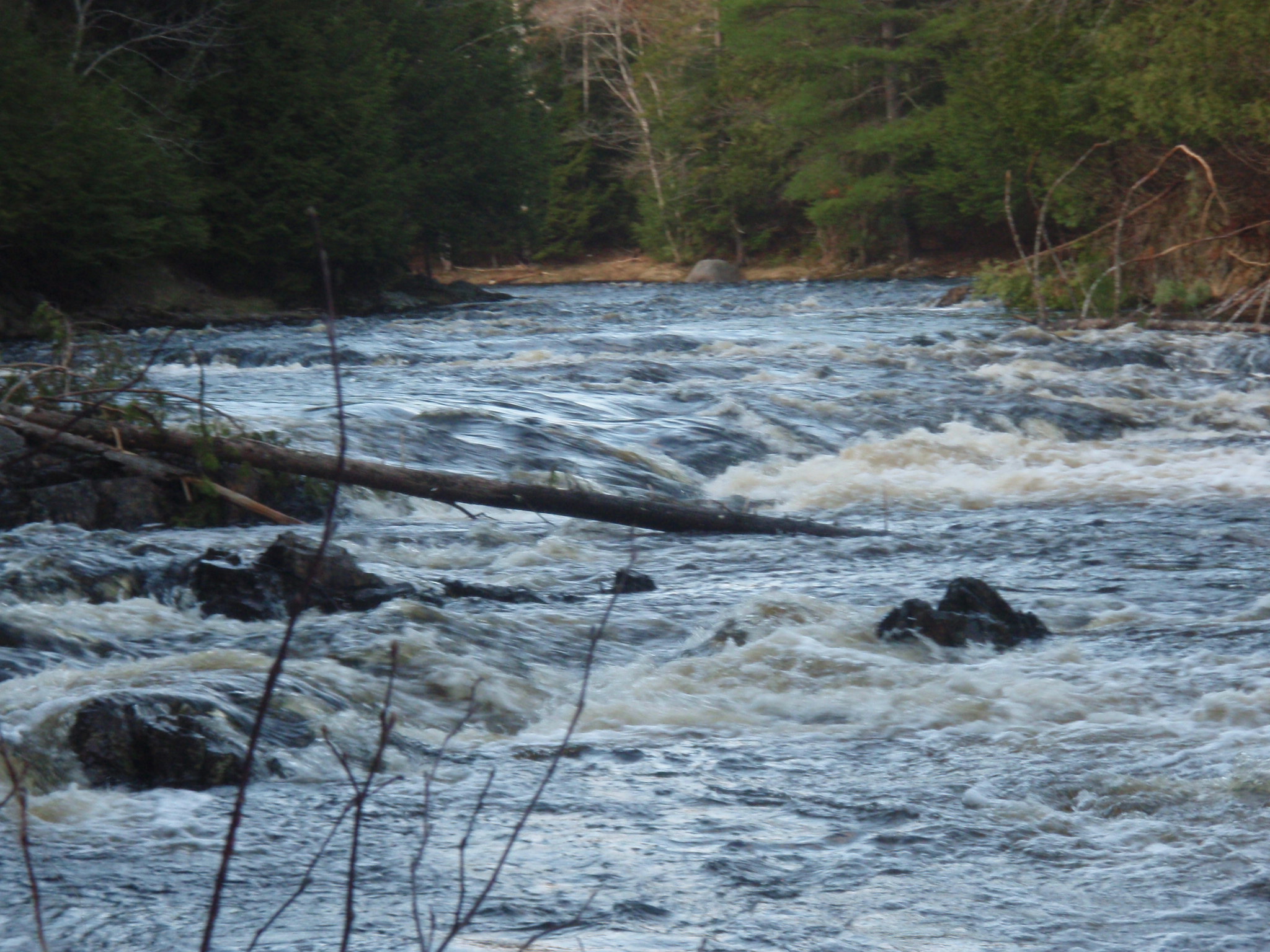
The ten miles of river have three distinct personalities.  From Swan Lake to Smith Pond, the river is shallow, muddy, and rife with beaver activity.  It winds through alder thickets and has a closed in feeling.  South of Smith Pond to Upper Mason Pond, the river deepens and and weaves through a broad grassland.   It becomes a home for geese, duck and muskrats.  The forest shrinks back, and the sky opens up,   The next stretch, from Upper Mason Pond to the sea alternates between flat reservoir and pitched stream, with each of the reservoirs being held back by a dam.

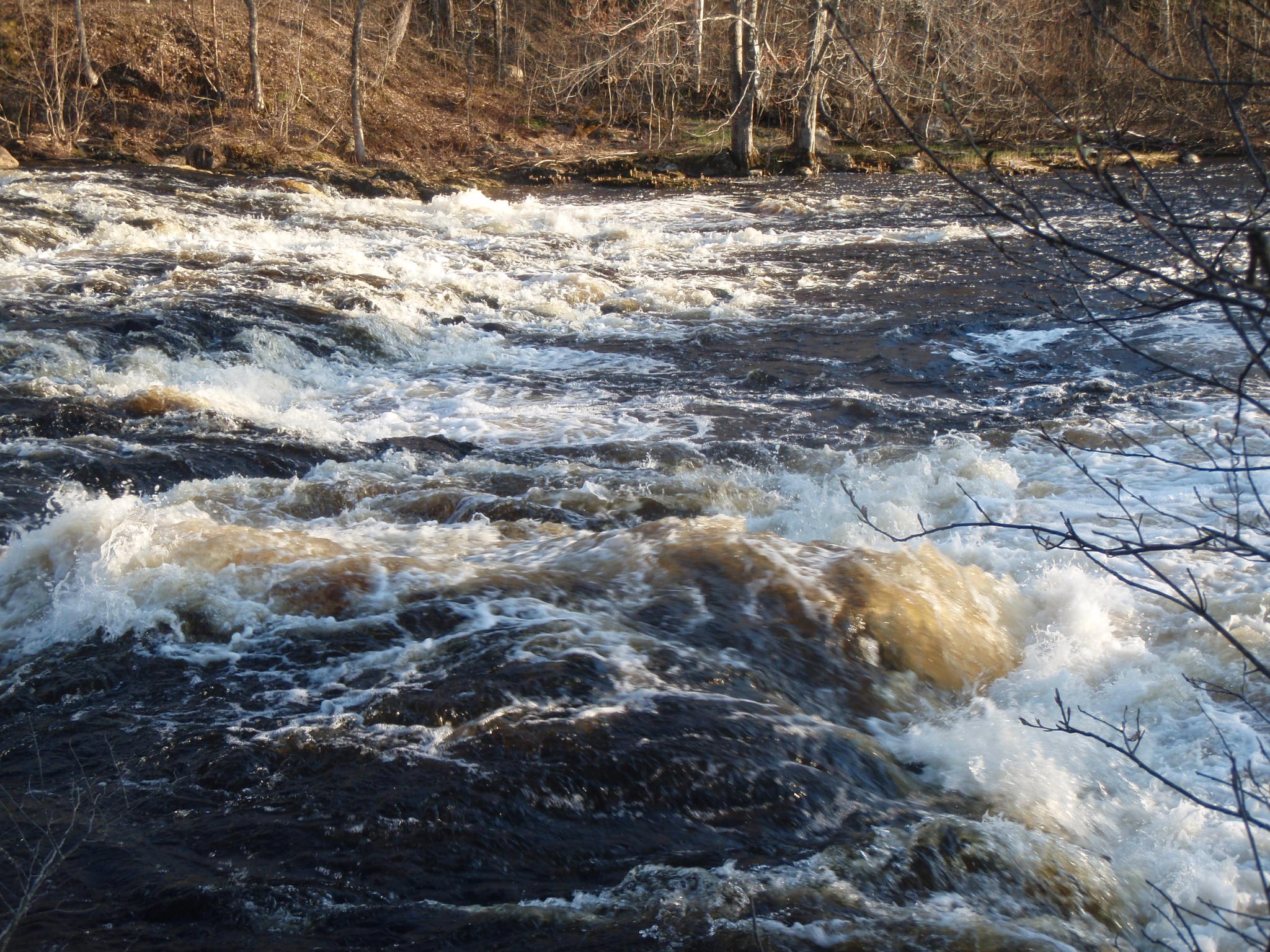
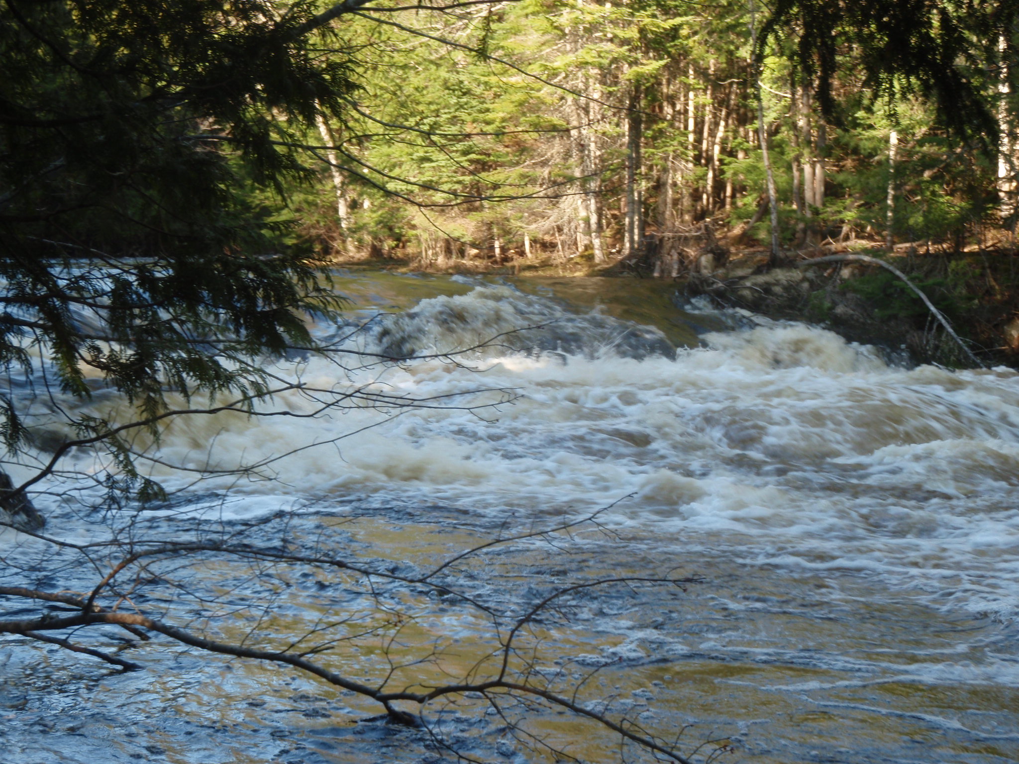
As we had anticipated, the water level upper section of Goose River was low, and the flow was minimal.  This section of the river is best paddled in the spring or early summer — or after a period of heavy rainfall. The river here meanders without much sense of direction.  We pushed over a beaver dam that held back about three feet of water.  Below that, the river depth was shallower still.  We paddled hard to keep some momentum through the many turns, well aware of the miles still ahead.

The deeper water of Smith Pond was a welcome relief.  We shared an energy bar there and pushed on.

The river meanders interminably between Smith Pond and the Smart Road — and even more so after that.  We had paddled this section many times and in many seasons.   On this day, the bright sunshine and the subtle hues of the grasses and distant hillsides created a quiet kind of beauty.

By the time we reached Upper Mason Pond, the sun was moving with purpose toward the horizon.  It hastened our purpose as well.   We portaged the first dam, got back in our kayaks, and paddled the narrow channel that opens into Lower Mason Pond, which was still lit with golden sunlight.

We had hoped to eat a late lunch there along a sunny shoreline, but daylight was becoming a scarce commodity.  We paddled on through the pond, portaged the dam, and then bumped down the shallow stream to where it crosses Swan Lake Avenue near Goose River Grocery.

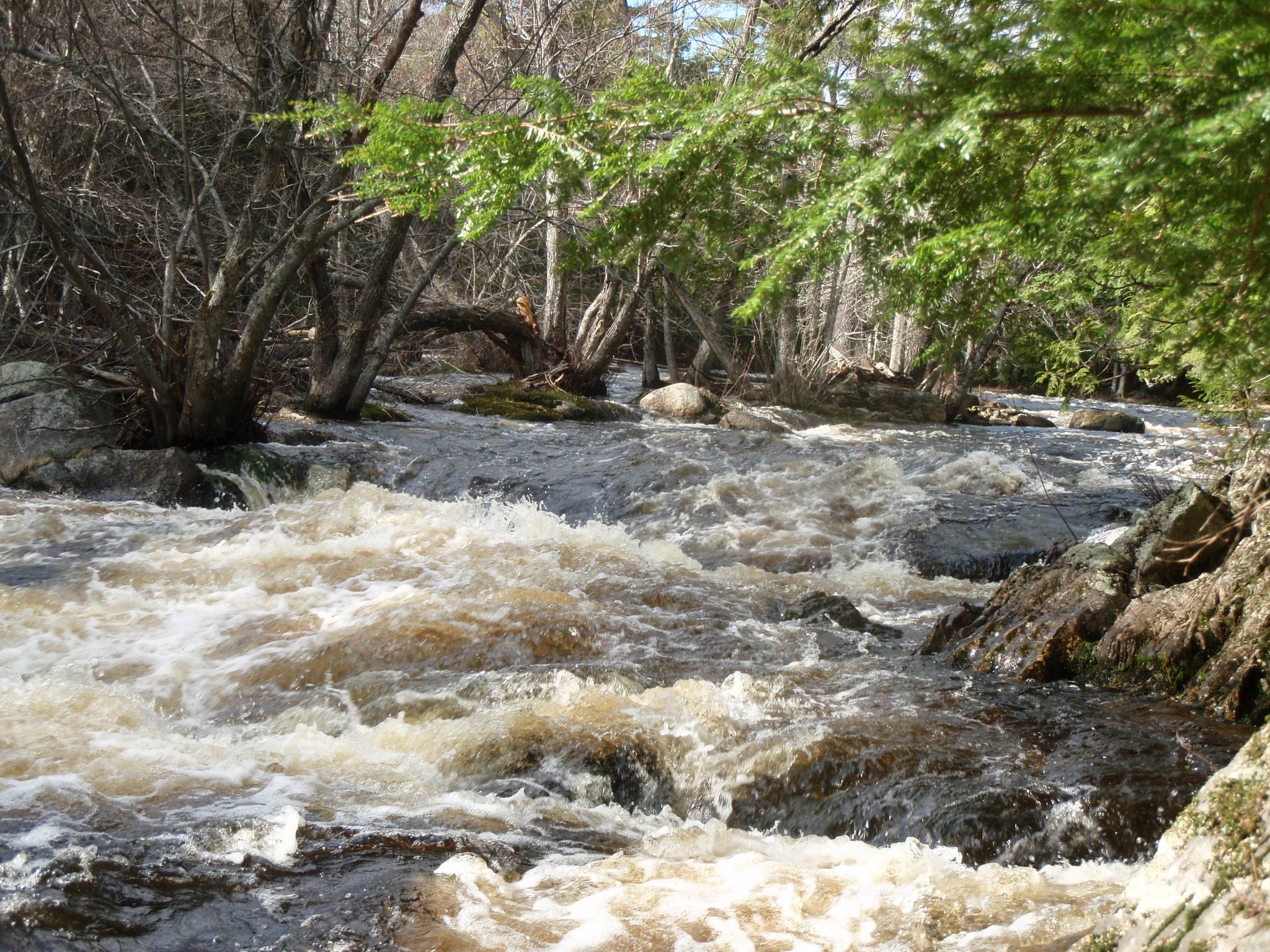
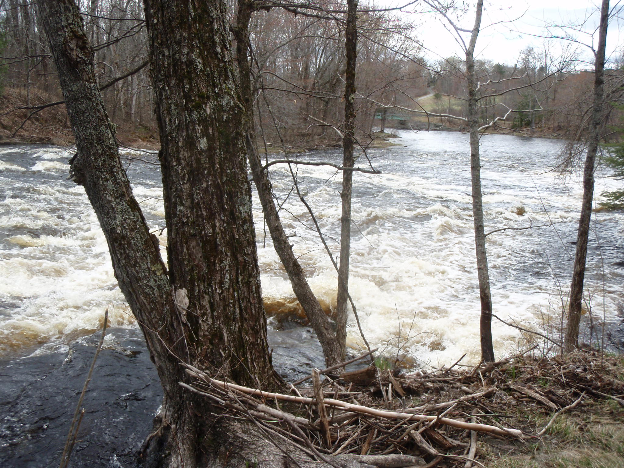
Two dams and two quick portages later put us again in the flat water of the reservoir above dam #6.

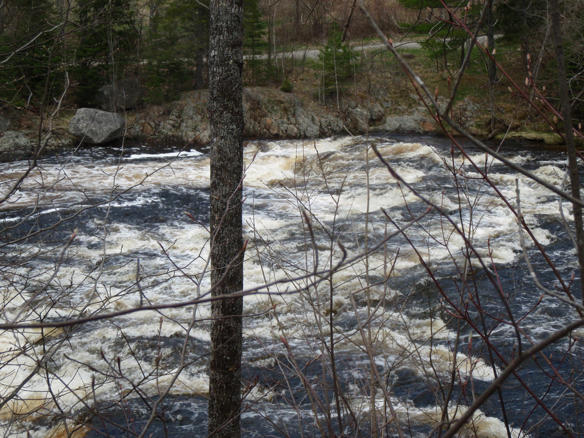
By this time, long shadows had crept over the water, though the sun still brilliant lit the the red and orange-leafed trees above us.  We took out at dam #6 and portaged around  it, and then along a wide, rock-filled stream — only to find that stream levels there were too low for paddling.

After walking down along the stream a few hundred yards to confirm that it wasn’t getting any deeper, we left the kayaks in the woods, bushwacked up to the road, and continued our southward journey on foot.   By then that the sun had set, and a chill filled the darkening air.  I jogged the last half mile in an attempt to warm up.  The car was parked down near the bay, and it was dark by the time I reached it.

Dry clothes, heated seats, and lunch were a welcome find  and helped ease the disappointment of not being  able to finish the journey by water.  But our path on and along the river had taken us places we had not been before.  Success is never guaranteed; adventures are only adventures because you don’t know the outcome.    And now we get to return and try again, to run the lower part of the river — maybe after a big November rain, or maybe in the spring.

Categories
Maine rivers whitewater wilderness paddling

Cruisin’ the Union: Kayaking the West Branch of the Union River

Great Pond to Amherst, 11 miles

Story has it that the Union River takes  its name from the fact that when the area was surveyed by Samuel Livermore  in the late 1700’s, the river ran right down the middle of twelve newly formed towns.

Nowadays, the upper part of the Union is in the middle of nowhere — and that is just fine with us.

The West Branch of the Union, north of the Airline Road, is billed as Hancock County’s “finest” whitewater run.  We ran it last Saturday for the first time, and it didn’t disappoint.

After a 50 mile drive from Belfast to Amherst via Bucksport and Dedham, we pulled over alongside Tannery Falls (just off the Tannery Loop) and unloaded our bicycles, which we would use later for our return to the put in.  We took a close look at the falls, which though rated “only” a Class III looked fairly gnarly.  Would we run the falls or take out above them?  We reserved that decision for later.   According to the Zip Kellogg’s canoeing guide, if exposed dry rock is visible at Tannery Falls, the river is  too low to run.  If the falls have the appearance of a raging river, it advises, “Don’t try to paddle the river.”  The level looked closer to raging than to dry, but “raging” — we decided —  is somewhat  a matter of perspective.

We drove 12 miles north to Great Pond via Aurora and the Great Pond Road.  After passing through the tiny village of Great Pond, the road turns steeply downhill to the Great Pond Recreation area (formerly Dow Pines), a military-owned campground (open year year; includes cabins and yurts as well as tent sites) that allows public use of their beach and boat launch.  The 375-acre recreation area borders the entire southern edge of Great Pond and also extends south along the western shore of the Union River.

We launched our kayaks from the sandy beach and headed south through  a bay that gradually narrows to the mouth of the river.  Great Pond is largely wild and undeveloped.  Kellogg comments that it is particularly beautiful in the fall, as the the pond is in the center of a bowl of hills and the surrounding slopes have plenty of hardwoods.

Although some sections of the river are not far from roads, The West Branch of the Union provides a sense of wilderness and seclusion.  We sighted no other paddlers, and only a few fishermen during our 11 mile river journey.  The area is rife with wildlife, however.  Hundreds of ducks as well as hawks, deer, turtles, blue heron, cormorants, beaver, and wild turkeys were among the wildlife we encountered.

The paddling was outstanding.  The river is larger and has stronger currents than most of our midcoast rivers.  That plus the seclusion and our unfamiliarity with the river made us a bit conservative.  The river has sections of flatwater, frequent stretches of rips and easy rapids, and a few stretches of  challenging whitewater (strong currents and decent sized waves).  Most notable are the drops.  The West Branch has multiple  small pitches of a few feet in height.  It also has four larger ones, with names like “Hell Gate” and “Captains Roll.”  Kellogg recommends scouting these drops and we emphatically  concur.  

The importance of scouting was reinforced by our experience at one of the earlier, easier drops. Without scouting it beforehand, we lined up to take the drop at Bog Dam rapids “right of center,” just as the guidebook suggested. However, immediately after taking the drop, I was spun and nearly capsized by a mossy green sleeper rock. Leslie, who had been following close behind, backpaddled to avoid my boat, never saw the rock, had her kayak pushed far up onto it, and was spun before finally capsizing. (See all the action in the video below).

Partly due to the time factor (it often takes longer to scout and then go back upriver and run a rapid than to simply portage it), we opted for short portages around the three major drops and took out above the fourth.  This was a recon mission — and for that day at least, just being in the vicinity of those falls provided plenty of adrenalin.

Those pitches are not easy to get out of your head.  I’ve been seeing Hell Gate in my dreams and am itching to head back up there and give it a try.

Categories
Belfast Maine rivers whitewater

3 Minutes on the Passy (video)

If the Passagassawakeag River isn’t the secret heart of Belfast, then it is at least its secret artery. Flowing out of the hills of Morrill and Brooks, it curves down through farmlands and forests before passing through the Shepherd Road dam, then tumbling down to tidewater at Head of Tide, and then gradually widening out to become Belfast Bay.

How many of Belfast’s residents, I sometimes wonder, have ever seen more than a lower mile or two of its 11 plus mile length?

On a sunny Thursday afternoon (Veteran’s Day) in November, the Passy was about as beautiful as it can be. We were happy to see that we weren’t the only ones out enjoying the river.

The Passy can also be enjoyed from its shoreline. The 44-acre Stover Preserve includes a 1.5 mile trail that loops along the lower Passy. To get involved in the Passagassawakeag Greenway Campaign, check this link.

We’re lucky people to have this kind of beauty so close to home. Here’s hoping you soon get a chance to get out and enjoy your local river!

Categories
kayaking Maine rivers St. George whitewater

Agog on Magog: Leaf-peeping on the St. George River

If you watched from space with a time lapse camera, you could see the broad band of fall foliage — the brilliant reds, oranges, and yellows  — move southward down the east coast like a wave.  That wave crested over the midcoast sometime last week and has now moved on more than 200 miles to the south.  Credit for this calculation goes to the Fall Color Guy, who states, “fall colors tend to move south at rates between 28 and 47 miles per day, depending on longitude.”

The 2.5 inches of rain that fell on the midcoast eight days ago brought local rivers to their own peak.  The Ducktrap River crested at 4.5 feet and 400 cfs, the highest levels since last spring.

The confluence of these two “peaks” made for some great paddling and leaf-peeping on local rivers.   Canoeists and kayakers were out on the St. George and the Passagassawakeag last weekend — and we were among them.  I also paddled the Little River (rain-swollen and newly wild) on Friday.

I know some 14-year old boys who would have made fun of us, but it would not be overstatement to say we were “agog” — awestruck, enthralled — as we paddled the St. George River south from Searsmont in the brilliant sunshine last Sunday.  The video below is an attempt to capture some of that beauty.

By the way, do any of you readers out there know the origin of the name for “Magog Falls”?  Magog is a city in southern Quebec.  The Magog Smelt is an old-time fly developed to fish for landlocked salmon.  And Magog (of the Gog and Magog tradition) is also a powerful nation/king/prince/giant who fights on the side of Satan in a war against God.  For which, if any of these, was the Magog Falls on Maine’s St. George River named?

Categories
kayaking maine Maine rivers paddling whitewater

The Slewgundy Heater, the Golden Boulder, and Other Hazards

If there is a theme to this blog, it is that Maine is laden with hidden treasure along its coasts and rivers and within its forests and lakes.

So I was particularly interested to learn about a legend of the Mattawamkeag area. The legend has it that there is a gold-bearing bolder in the Gordon Brook woods near the Mattawamkeag River. The only catch is that the boulder casts a curse on those who try to find it.

We were too busy dodging rocks to spend much time looking for golden boulders as we paddled down the Mattawamkeag last weekend. The river, which runs up to Class V, depending on the time of year, was running at a very moderate  850 cubic feet per second, but it was still one of the more challenging rivers we’ve paddled.

We were staying at the Mattawamkeag Wilderness Campground, itself certainly right up there amongst Maine’s hidden treasures.  This clean, quiet, old-timey campground has spacious sites, several miles of river frontage, and is surrounded by a thousand acres of wilderness.  After moving our boats 100 yards upstream so we could run the Scatterack, the Class II rapid that fronted our campsite, we put in and began our adventure.  A fisherman from a nearby campsite voiced concern when he saw that we were heading off in sea kayaks.  “We know what we are doing,” I assured him.  I sure hoped we did.


We had paddled other Class II and III rivers in sea kayaks.  We had read everything we could about the river and had scouted the most difficult section the day before.  Still there is that element of doubt as you put in on an unfamiliar river.

The first mile was made up of easy whitewater and provided an excellent warm-up.  About a mile from the campsite the river goes around a big bend to the left before entering a narrow gorge, the infamous Slewgundy Heater.  The evening before, by lantern light, we had read of the graves of 7 river drivers that line the  Slewgundy.  We had also read of the man who was killed while canoeing Upper Gordon Falls a half mile below.

We were so focused on the hazards of the gorge itself that we were surprised by the strength of the rapids at its entrance.   Here we found a section of river with strong currents, large waves, and rocks that required quick maneuvering.  Then, at once, we were inside the gorge, and after a 3 foot drop, the river was strangely calm.  There we were in the narrow canyon, with the 40 foot rock walls above us and the roar of the river both above and below.  Beneath us and around us the river was tranquil, dark, and flat.

We took advantage of the calm water and eddied out  to scout the most difficult section of the whole river, which as just ahead.  After some scouting and more than a little debate, we decided on a route that would take us into a hairpin turn along the far right bank.  From there, we would need to reverse sweep to cut across the current to the right and then quickly turn left to line up for a final 3 foot drop.

Hearts pounding, we ran the drop successfully if not perfectly.  We were out into daylight.  Out of Slewgundy’s maw.

After a mile of easier whitewater, we came to Upper Gordon Falls, which is “bony” and requires a portage at medium water levels.  Below Upper Gordon, we stopped for lunch and to swim in the river, which in the 80 degree heat seemed unnaturally warm.  Then it was on to run Lower Gordon (a Class III drop with big waves).  Below Lower Gordon the gradient decreases and the river widens.  Acres of boulders are strewn about this widened riverbed, creating a different kind of challenge for the paddler.  A few smaller drops keep it interesting.  We paddled on, under the railroad bridge and then the Route 2 bridge, and then on to the confluence with the Penobscot.

Mattawamkeag means “at the mouth, a gravel bar.”  True to its name, the mouth of the Mattawamkeag is still marked by a gravel bar just a few yards north of where it flows into the Penobscot.  We floated at the confluence for a few minutes, testing the temperature of both rivers with our hands.  The Penobscot was several degrees cooler, we decided.

Rather than ending our trip there, we paddled the Penobscot 4 miles south to the boat landing in Winn.  After the thrills of the Mattawamkeag, we had anticipated the Penobscot would be flat and less interesting.  We were happy to find it was neither.  The river here is nothing like the deep somnolent river near Bangor and Bucksport.  It is lively and braided and shallow with rips and rocks and sections of whitewater.  The riverscape is interrupted with breezy park-like islands forested with oak and maple.  In the deepening afternoon shadows, we curled through Five Island Rapids and then paddled back into the sunlight and on to a second set of islands that marked our take out in Winn.

We were sorry to leave the river but we still had adventure ahead.  It was a 12 mile bicycle ride (4 on pavement, 8 on dirt) to get back to the campsite.  Then a 24-mile car trip (16 on dirt, 8 on pavement, you get the idea) to pick up the kayaks.  Then a 10:00 pm dinner at our riverside campsite and later to fall asleep with the river still in our ears.

We liked it so much, we were on the river by 1:00 pm the next day to do the whole thing again.

The story of the golden bolder seems to be a somewhat commonplace warning against excessive ambition and greed.  On another level, it seems to teach that there are undiscovered riches out there — that can perhaps be found and appreciated only by those who are happy to be there for the sake of being there, who are not seeking anything tangible from the experience, who are seeking only the experience itself.

Resources:
Mattawamkeag Wilderness Park Campground 
Gordon Falls on the Mattawamkeag (geology of the lower Mattawamkeag River)
Mattawamkeag River Stream Flow (river gauge)
Mattawamkeag Park to Open May 28 (BDN news article)

Categories
kayaking maine Maine rivers paddling whitewater

Living it Up on the Dead: Kayaking the Lower Dead River

Categories
Downeast Maine Maine rivers

Double-Take on Second Lake: A Kayak Trip from Rocky Lake to Second Lake via the East Machias

There we were, on a wild lake shore, 8 water miles from the put in and roughly 3 miles (as the crow flies) from our vehicle. We stood on a sawdust beach on the southern end of Second Lake in Downeast Maine. We were essentially right smack in the middle of the 11,000 acre Rocky Lake Public Reserve Lands. The sunset, less than an hour away, would be remarkable.  It was 7:15 pm and we were hoping finally (that’s another story) to each lunch. Our plan was to walk or catch a ride to our vehicle and then drive back and pick up the kayaks.  Trouble is, the boat landing and vehicle access road promised on the Delorme Atlas map as being adjacent to the lake, simply were not there. “Double-take” is probably an understatement in this case.

We could walk out the narrow, mossy mosquito-infested trail that led away from the beach, sure. But how to get the kayaks and gear (combined weight of more than 150 pounds) out to the road? And just how far was it to the drive-able road, anyway?

As a trip leader, I spend a lot of time re-tracing familiar routes. It’s a treat, then, to explore new territory, with only a map as a guide. However, that old Alfred Korzybski adage, “The map is not the territory,” is often quick to manifest itself on such trips, just as it had on this one.

Later, looking closely at the updated Delorme atlas (the one we were using was maybe 5 years old), I could see that the double-dashed unimproved road between Rocky Lake and Second Lake becomes a smaller double-dashed trail as it approaches Second Lake. The distinction was a lot more significant to us than to the map-maker.  Let’s just leave it at that.

We had put in on the southern shore of Rocky Lake about four hours before. We paddled north, upwind along the western shore of Rocky Lake. True to its name, this pristine wilderness lake is rocky, shallow, and features a number of islands. We sighted only a handful of camps on our 3-mile trip up the lake shore. Near the northern end, we turned up Rocky Lake stream, a wide green river that meanders northwest through marshlands and is joined by the equally wide and placid Northern Stream before meandering southwest to join the East Machias River below Round Lake.

We then followed the East Machias south through more marshlands, past Oak Point Meadow, to the bridge above Munson Rips. At the bridge, the river narrows  and quickens for a quarter mile of Class I whitewater. Then it reverts to its previous character — slow unrelenting flatness — to Second Lake.

While Leslie fixed lunch, I dragged the first kayak down the overgrown trail, fending off mosquitoes with my free hand, and hoping the trail would take me out to a driveable road sooner rather than later. Fortunately, it was no more than a hard 5 minute drag that included a mud-hole, several downed trees, and a steep bank that required clambering. (Adventure races, in which people pay to carry heavy objects through the mud, are becoming all the rage, I reminded myself.  This experience was entirely free.)  Then it was back to fetch the second kayak and then back again to the lake shore for sunset and “lunch.”

We walked together up the trail, past the kayaks, and onto the graded dirt of the Diamond Match Road. The mosquitoes were bad enough to make us think wistfully of the  headwinds we had faced all the way up the lake. But the footing was decent. There were no vehicles to dust up the road, and we made good time in the diminishing light. We reached the Rocky Lake camping area before dark and then drove the 2.5 miles back toward Second Lake to pick up our kayaks.

Our time in the Rocky Lake Public Reserve Lands was all too short.  This is a pristine and relatively unheralded wilderness of interest to paddlers, mountain bikers, birdwatchers, and fishermen.  Wildlife sightings are said to be common.  During our brief stay, we saw eagles, osprey, ducks, loons, beaver, and turtles. According the the BPL website, fish found in reserve waters include small mouth bass, white perch, yellow perch, chain pickerel, alewife, American eel, white sucker, fallfish, and pumpkinseed sunfish.  Camping is available at a number of primitive lake shore tent sites and also at a shelter on Rocky Lake.  

Read more about this wilderness area at Bureau of Public Lands and Wildernet.com

Categories
Downeast Maine Maine rivers whitewater

Communion on the Union: Kayaking the Union River, West Branch

Something happens when you get out on a river,  after you are several miles downstream from the put- in, and while you are drifting down through a dense corridor of trees that screens out the surrounding world, especially if the weather is warm, the sunlight is on the water, and you have not paddled this particular section of river before.

You have this sense of not being able to place yourself.  You have no idea what is around the next bend.  True, if pressed to it, you could point out your rough location on a map.  But, by just looking around, you could be almost anywhere.  You could even be that younger version of yourself who paddled a similar-looking river years ago.   But you’re not.    You’re right there, wide awake and looking.  Time is something you have forgotten about.  You drift onward.  You paddle.  You drift..

We had some of those moments while paddling the West Branch of the Union River a week ago.

At this time of year, as the river levels drop and temperatures warm, our attention usually shifts to the coast rather than the rivers.  However, a weather forecast calling for wind gusts of up to 30 mph last Sunday gave pause to that inclination.  It would not be a good day to venture offshore.  Paddling any upwind legs along the coast might prove to be daunting.  Tragically, as we learned later, this was to be the day that two young women died at sea while kayaking off Peak’s Island in Southern Maine, a reminder that winds over 20 knots add significantly to the risk level for all but the most experienced kayakers.

 For the previous two days, forecast in mind, we had studied maps and guidebooks.  Waldo County rivers were running low from the lack of rain.  But we theorized that the Union River, with it’s large catchment area, would still have adequate water.  And we were intrigued with the West Branch of the Union, which we had never paddled, and which is described in Delorme’s Canoeing Guide as “Hancock County’s finest whitewater run.”  If the river was too low, we would paddle the northern narrower section of Graham Lake.  Since the winds were out of the northwest, we would aim to paddle south — and later bicycle back our starting point.

After leaving our bicycles 12 miles to the south on Graham Lake, we put in on a beautiful stretch of river along Tannery Road in Amherst.  The first mile consisted of shallow easy class I rapids.  After passing under the Route 9 bridge, the river slowed and deepened.  Trees exploding in spring green crowded the banks.  We would not see a house or a road for the next 8 miles. 

According to the guidebook, a century ago, the Union was a hub of industry with sawmills and tanneries crowding its banks and timber from log drives clogging the river itself.  Today it is pristine, woodsy, and wild in appearance.  We saw huge snapping turtles napping on rocks.  Eagles swooped low overhead.

Above Mariaville Falls, the river quickened and we heard the rush of water below. We portaged along a rough trail on the right bank and put in just below.  The next quarter mile was punctuated by three class III  ledge drops and a maze of rocks. The low water level and relatively weak current allowed us to scout and learn this tricky section of river at a manageable pace.

Below the ledge drops, the river again slows and deepens, with just a few more sections of easy whitewater.

The river gradually widens into man-made Graham Lake, which still provides evidence of its pre-lake days in terms of the large tree trunks still protruding from the surface.  There is an option to take out at Goodwin Bridge (Route 181), but we continued several miles south, to just past the confluence with the East Branch, to the Morrison Road boat launch.

Notes:  Our trip on the Union was following a period of several weeks without significant rain.  In my estimation, this section of the Union should be runable any time the Ducktrap  gauge reads at or above 2 feet and 10 cfs, as those were the readings on the day we paddled it.

A possible side trip is to paddle up Union River East Branch several miles to falls.  Another section of interest is north of our put-in in Amherst.  After return to launch site, we walked up the River Road to investigate the section north of Tannery Road.  At this level, it was rocky, gorgeous, and too low to run, but it would be a lot of fun with more water.  We also left the section south of Graham Lake for another time.  The annual Union River Race, featuring this section from the Graham Lake dam to the Ellsworth town boat ramp, is upcoming on June 12th.

Categories
Maine rivers paddling whitewater

Maine Whitewater Season Begins March 27

Early rains and early snow melt make for an early whitewater paddling season. Paddlers have been out on the St. George River, the Passagassawakeag River, and the Marsh Stream, among others.

The first whitewater race of the season is the annual YMCA-sponsored St. George River Race on Saturday, March 27. The full race schedule, which continues on through the spring and summer, is now up on the MaCKRO website. Those who catch the fever can race just about every week until October.

Whitewater racing (and especially early season whitewater racing) may not be for everyone. However, as Waldo County YMCA director Dale Cross states in a recent BDN article, the first two races of the season are among the easiest — and they help prepare paddlers for more challenging races later in the season. And newcomers needn’t be intimidated by the term “race” as it only loosely applies to the experience of many who participate in these events. For many paddlers, these “races” are an opportunity to get out on the water, have fun, and hang out with other paddlers — and maybe get a new t-shirt in the bargain.

Having at least a little paddling experience doesn’t hurt. Having a wetsuit and neoprene gloves doesn’t hurt either. Many of the more experienced paddlers shun wetsuits, however. Cold water is a concern — but often the heat of the race helps paddlers compensate for that. Many of those who have paddled the Kenduskeag Stream race on a 50-degree April day state that by the time they reached Six-Mile Falls, they were so overheated, the thought of a swim was actually quite enticing.

The MaCKRO forum is a great place for aspiring paddlers and racers to ask questions, find paddling buddies, borrow equipment, and more.

See you on the river!

Categories
kayak kayaking Maine rivers paddling St. George

Fall Whitewater and Other Well-Kept Secrets

The morning of November 29 started sunny and seasonally cool, with temperatures in the low 30’s. By 11:00 AM, there we were, paddles wheeling through the bright water, embarking on a trip that would include a heretofore unexplored stretch of our favorite Maine river. We had planted a vehicle in Appleton, some 10 miles away. Besides a few sentences in a guidebook printed 20 years ago and a quick perusal of the section on Google Earth, we had nothing to go on — which suited us just fine. Seeing something new, in essence, is what river travel is all about.

We put in on the St. George River in our usual spot in Searsmont. The water level at the put-in — several feet up over the “summer banks” proved to be an omen for good paddling. The river south of the Ghent Road bridge was fast, deep, and full of standing waves. The drop at Magog (usually considered a Class III) was fun and easy.

In the past, we’ve taken out at the Route 105 bridge– and looked wistfully on downstream, but this time, riding the swift current and with the late fall sunshine full on our faces, we were on our way down a wooded corridor that (if all went well) would bring us out at the Sennebec Road bridge in the center of Appleton.

The Class I-II rapids south of the Route 105 bridge transitioned into flatwater a few hundred yards below. Much of the rest of the trip to Appleton was flatwater, mixed with some easy Class I. At one point, an eagle soared high overhead. A beaver crossed the glassy surface in front of us, creasing the water with his wake. Stands of hardwoods lined the banks. Lazy trees extended far out over the water, their trunks just above our heads.

In a few places, downed trees formed strainers and thickets that we had to “river-whack” our way through. A hundred yards above the Appleton bridge, the current picked up and the rapids become a Class II. We took out above the bridge and then walked the bridge and the river, studying the drop and plotting our next trip in which we are pledged to “paddle on through.”

Previously I subscribed to the myth that whitewater season here in coastal Maine is limited to a couple of months in the spring. This year, beginning in March, we got out on the local rivers in every month but August. Even now, in late November, the water levels are high — and the water temperatures are warmer than in March or April.

In fact, the greatest “hardship” of paddling this time of year is that the southern trajectery of rivers like the St.George together with the low angle of the sun combine to light the whitewater like silver fire. This makes seeing (and avoiding) the rocks more difficult. But, especially for those who might feel sunlight-deficient this time of year, it is an easy hardship to endure.