Categories
Acadia Deer Isle Island Camping Maine islands sea kayaking wilderness paddling

From Ear to Ear: Kayaking Around Isle au Haut

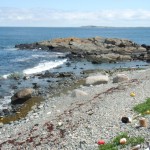
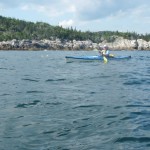
The southern tip of Isle au Haut, between the rocky islets of Eastern and Western Ear, is an otherworldly place of rock, ocean, and sky.   Along with the southern shores of Monhegan, Matinicus, Schoodic, and Great Wass, it is among the most exposed places on the Maine coast.  Kayaking this  remote stretch of coastline is not for the untrained or faint-hearted.

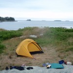
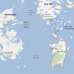
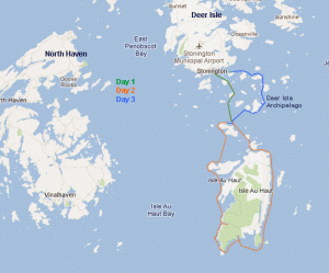
Sea conditions last Saturday (July 30) were settled enough for us to give it a try, and try we did.  On the day before, we had paddled out of Stonington under grey and somewhat ominous-looking skies. We dodged south around Scott, Green, and St. Helena Islands, seeking protection from the stiff headwind when we could find it.  Steve’s Island, a favorite, was occupied by a group of kayakers, so we pushed another mile across Merchant Row to Harbor Island, a BPL Island that is also part of the  Maine Island Trail, where we set up camp for the night. After a night full of rain and wind, we set off the next morning for a 20-mile circumnavigation of Isle au Haut.

As we paddled south between Burnt Island and Isle au Haut, the fog thinned, the wind eased, and our spirits lifted. The forecasted day of blue skies and light and variable winds seemed to be materializing after all. The winds from the night before were still present in the form of a storm swell that rhythmically rolled in on us from the east.

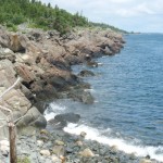
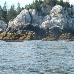
The eastern coastline of Isle au Haut is cliff-lined, rocky, and varied. Well-maintained homes and estates are interspersed along its shores. A procession of ledges and islands line the horizon to the east. These ledges and islands provided welcome protection from the storm swell. As we neared the high cliffs of Eastern Head, swells were converging from two directions —  from the southeast and the southwest — making for confused sea conditions and difficult paddling.

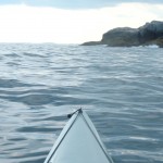
We shot the passage between Eastern Head and Eastern Ear.  Swells whose crests rose  above our heads raced toward us.   Powered by adrenaline, we dug our paddles in and pushed up over the wave crests.   With0ut a doubt, rounding the southern part of Eastern Ear was the most challenging part of the trip.

The seas there were steep-sided, confused, and — counting the refracting waves off the cliffs — now coming from three directions at once. Occasional guillemots marked the water. Occasional lobster boats marked the horizon. Other than that, it was just the two of us, the distant cliffs, and the big sea. Out there, in that wild and foreign environment, the smell of the sea sharp in your nose, the sunlight bright in your eyes, and the swells lifting under you, the very planet seems to palpitate, to hum, and to roar.  Your senses are so wide awake, it is as if you can hear the earth’s heartbeat — and your own heartbeat too.
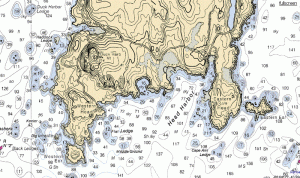
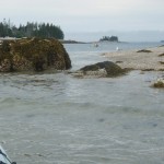
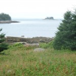
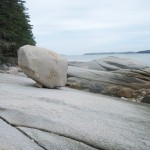
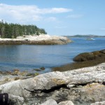
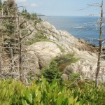
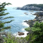
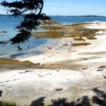
The southern coast of Isle au Haut

We stayed far offshore to minimize the effects of the refracting waves and paddled steadily across Head Harbor, looking for a beach where we might land or a shoreline where we might get some relief from the waves. By this time, the seas seemed less dangerous, but paddling still required our full attention.  A moment of inattention and a capsize in these cold waters was not something we wanted to deal with.

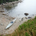
At last, we made our way west-northwest into a somewhat protected cove and landed on a rough cobbled beach.

After lunch and a short hike along the shoreline cliffs, we launched our kayaks and paddled around Western Head. By then, the winds had calmed and the storm swell had diminished. The waves out of the southwest were still large enough to keep us from getting too close to the cliffs. The tide was too low to allow us to shoot the passage between Western Head and Western Ear, so we rounded the ear and turned north into progressively calmer conditions.

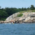
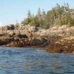
The afternoon light dramatically highlighted the cliffs of the wild shoreline north of Western Ear.  We paddled on happily, feeling assured that the most  difficult conditions of the day were behind us. The sky was blue; the sun was friendly and warm. We loitered among the ledges, watching seabirds, taking photos, and gazing at the cliffs.

We paddled into Duck Harbor to replenish our water bottles and quickly check out the campground, which I had not visited in several years.

As we moved north from Duck Harbor, we felt both a sense of haste (the day was waning) and leisure (the light was beautiful, the water was calm and increasingly glassy).

We crossed past the western edge of Kimball Island, paddled east along Kimball Head, and then swung north toward the southern shoreline of Merchant Island. The subtle “huff” of a harbor porpoise is something I heard several times without being able to confirm it. And then we started to see them, repeatedly breaching the quiet water as they worked the ledges for fish. We spent a entranced half an hour moving among the breaching porpoises while they moved around us.

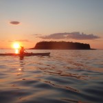
By now the sun was nearing the horizon. It was time to make a push for our campsite on Harbor Island. We rounded the western shore of Merchant, paused to watch the sunset, and then returned, tired, hungry, and happy to our campsite.

Resources:
NPS.org:  Duck Harbor Campground
Mountainzone.com:  Western Head and Cliff Trails
IsleauHaut.com:  Isle au Haut Boat Services
Sea Kayak Stonington:  Around Isle au Haut
Isleauhaut.org:  Isle au Haut Facts
Categories
Downeast Maine Great Wass Island Camping Jonesport kayaking Maine islands The Sands

Sleeping on a Tide Table: A Kayak Trip to The Sands, off Jonesport, Maine

” . . A smidgen of ledge and sand that lies between Inner and Outer Sands Islands. But it’s a beautiful smidgen,with Petit Manan Point in the distance to the west and Great Wass Island a looming presence to the east . . . It is open to any weather, and the highest tides sweep right over the island. It’s a nice place to visit when the seas are calm. –Dorcas Miller, Kayaking the Maine Coast

The Sands is an enchanting place, little more than a sand bar, about 10 miles south-southwest of Jonesport, Maine. It’s a Bureau of Public Lands island visited by seals, seabirds, the occasional plucky kayaker and not much else. The panoramic views. The openness to the sky. The fineness of the sand. The spectacular remote location with Inner and Outer Sands islands nearby and the mountains of Acadia and the Camden Hills visible in the distance. The closeness (and vulnerability) of the island to the tides — all make it unique, and endearing. I have visited The Sands a half dozen times over the last half-dozen years and have had it in the back of my mind that one day I would camp there.

In mid-August, a span of 4 days off, settled weather, light winds and an enthusiastic paddling partner each pushed the window of opportunity open a bit further. A little voice spoke to us, and the voice said, “Go for it.” A pre-trip examination of tide tables showed that we were due for some of the highest tides of the year, which would make camping on The Sands even more dramatic — and, if the seas were not calm, foolhardy.

According to the charts, we were due for the highest tides of the month, perhaps the highest of the year. (See this link for an explanation of why some tides are higher than others). The height of the tide in Jonesport on August 20th was forecast at 14.3 feet , at least 2 feet above the average. The forecast called for continuing settled whether, a clear night, and nearly windless conditions, which would be ideal — and necessary — for camping on The Sands.

We put our fully loaded kayaks in at Indian River at the top of the tide and rode the retreating tide south out along the eastern shore of Crowley Island, much of which is owned by the Pleasant River Wildlife Foundation. Our route then carried us past the Goose Islands, Duck Ledges, Hardwood Island, Stevens Island, Drisko, and Inner Sands.

On Stevens Island, we saw (and smelled) the decaying carcass of a 30 to 40 foot whale . Comments in the Stevens Island logbook (Stevens is a BPL Island and part of the Maine Island Trail) identified the carcass as that of a right whale and indicated it had been the for more than a month. Later I read online that right whales are a precariously endangered species — as stated by RightWhale.org “the world’s rarest, large whale, continues to face many problems on its slow road to recovery.”

Arriving on The Sands at around 4:00 PM, just after absolute low tide, we trekked up the intertidal zone to the highest point on the island — a vertical rise of approximately 16 feet. There we examined the rings of seaweed that served as footprints of recent high tides. If they proved to be an accurate indicator, our island would shrink to little more than 45 feet x 15 feet at the time of high tide, about a half hour before midnight that evening.

The weather was calm and the sunset was spectacular. This was reassuring. I will admit to feeling a tad anxious as the moonless night deepened and the dark ocean drew closer. Before zipping myself into the tent, I re-checked the kayaks. Earlier I had secured the hatches and cockpit openings, made sure paddling paddling gear was ready for use, and tied the kayaks to our tent. If the wind picked up or the tides were higher than predicted, it might mean abandoning the tent and sleeping bags — and making a midnight headlamp-illuminated paddle to nearby Inner Sands Island. The bouldered shoreline there would make for a difficult landing, especially in the dark, but that was the fallback plan.

We retreated to our tent by 10:30 PM or so — and listened, as only one on such a small island can listen, as the tide crept closer and the constant cacophony of gentle surf approached from all sides. We were still awake at midnight when the surf began to slip back, away from us. We did not look out but slept assured that we had remained dry through the advance of the tide and that our island was now growing larger again.

We woke to thick fog. The forecast of increasing winds and unsettled conditions meant our hope to spend more time on The Sands — and to explore the islands to the south and southeast would have to wait for another time. (As it happened the first waves from Hurricane Bill would reach that area in less than two days.) After packing the boats, we island-hopped our way back to Crowley Island, navigating largely by compass, as visibility in the fog was less than 1/4 mile. We returned up the west side of Crowley Island, which is largely privately owned and rockier than the eastern shore.

The trip was — through both conscious effort and fortunate happenstance — carried out in a happy harmony with the tides. We put in at the top of the tide and rode the retreating tide south to The Sands. We set up camp and cooked dinner and then retreated to our tent just as our island shrunk to it’s smallest dimensions. We woke the next morning to an expanded island, breakfasted in the same “kitchen” that had been washed clean by the last night’s waves, and then launched as the tide reached within a dozen feet of our kayaks. Our trip north through the fog was slowed by the dropping tide. We reached the bridge to Crowley Island just in time to avoid becoming hopelessly marooned in a sea of brown mud.

Some would undoubtedly think such a trip needless at best and foolishly dangerous at worst. Why do it then? A place like that certainly opens up your senses. Perhaps also because the experience of sleeping on a sand bar just a few feet above the tide puts us back in touch with the truth that our survival does depend on the fine balances in nature. The reality is that in our lives as individuals and in our survival as species, we live daily on the brink of survival and on the brink of calamity. That brink, that edge where the tide comes in and engulfs dry land, can be a frightening place — but also a beautiful one.